Important Facts For Prelims
Geospatial Energy Map of India
- 19 Oct 2021
- 3 min read
Why in News
Recently, NITI Aayog launched a comprehensive Geographic Information System (GIS)-based Geospatial Energy Map of India.
- Earlier in July 2021, the Association of Geospatial Industries released a report titled “Potential of Geospatial Technologies for the Water Sector in India''.
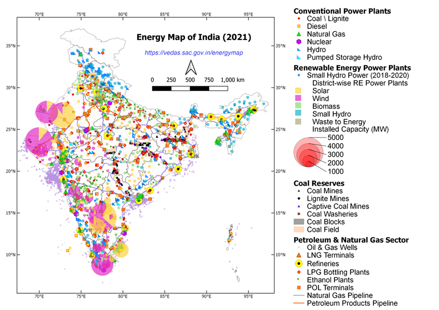
Key Points
- About:
- It is developed by the NITI Aayog in collaboration with Indian Space Research Organisation (ISRO) with the support of Energy Ministries.
- It provides a holistic picture of all energy resources of the country.
- It enables visualisation of energy installations such as conventional power plants, oil and gas wells, petroleum refineries, coal fields and coal blocks, district-wise data on renewable energy power plants and renewable energy resource potential through 27 thematic layers.
- Geographic Information System:
- A GIS is a computer system for capturing, storing, checking, and displaying data related to positions on Earth’s surface.
- It can show many different kinds of data on one map, such as streets, buildings, and vegetation.
- It enables people to more easily see, analyze, and understand patterns and relationships.
- Significance:
- Aims to Identify Sources of Energy:
- It attempts to identify and locate all primary and secondary sources of energy and their transportation/transmission networks to provide a comprehensive view of energy production and distribution in a country.
- Integrate Scattered Data:
- It is aimed at integrating energy data scattered across multiple organizations and to present it in a consolidated, visually appealing graphical manner.
- Advancements in Web-GIS Technology:
- It leverages the latest advancements in web-GIS technology and open-source software to make it interactive and user friendly.
- Helpful in making Investment Decisions:
- It will be useful in planning and making investment decisions.
- It will also aid in disaster management using available energy assets.
- Aims to Identify Sources of Energy:
Geospatial Mapping
- It is a type of spatial analysis technique that typically employs software capable of rendering maps, processing spatial data, and applying analytical methods to terrestrial or geographic datasets, including the use of geographic information systems.
- It is different from traditional mapping, as geospatial mapping provides us with computerized data that can be used to create a custom map designed for your needs.


