Biodiversity & Environment
The Development Dilemma of the Andaman & Nicobar Islands
- 20 Jan 2026
- 25 min read
This editorial is based on “A hidden epidemic in Andaman” which was published in The Hindu on 18/01/2026.This article examines how the Andaman & Nicobar Islands’ strategic geography, ecological richness, indigenous communities, and defence significance intersect, revealing the challenges of balancing national security with environmental sustainability and human well-being.
For Prelims: Great Nicobar Island Project,Coral Bleaching ,Andaman and Nicobar Command (ANC), Galathea Bay
For Mains:Significance of Andaman and Nicobar island for India, key issues and measures
Located at the strategic maritime crossroads of the Bay of Bengal and the eastern Indian Ocean, the Andaman and Nicobar Islands form India’s easternmost security outpost astride vital international sea lanes. Yet, behind the postcard imagery of turquoise waters and thriving tourism, the islands are grappling with a silent social crisis, a suicide rate more than three times the national average, revealing deep-seated stresses within this isolated geography.
With a small and scattered population of around four lakh, this paradox underscores how strategic importance and natural beauty can coexist with profound human vulnerability.
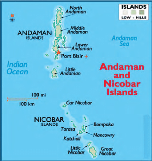
Andaman and Nicobar Islands
- The Andaman and Nicobar Islands comprise an archipelago of over 570 islands stretching over a distance of more than 700 km in a north–south direction at the junction of the Bay of Bengal and the eastern Indian Ocean.
- Located about 1,300 km from the Indian mainland and in close proximity to the Malacca Strait (one of the world’s busiest maritime chokepoints) the islands form India’s easternmost frontier and a natural maritime outpost overlooking vital global sea lanes.
What is the Significance of Andaman and Nicobar Islands for India?
- Environmental and Biodiversity Sensitivity: The Andaman and Nicobar Islands constitute one of India’s most ecologically fragile regions and form part of a globally recognised biodiversity hotspot in the Indo-Burma biogeographic zone.
- Nearly 90% of the land area is under forest cover,the Great Nicobar Biosphere Reserve hosts diverse ecosystems, including tropical wet evergreen forests, rugged mountain ranges rising up to 642 m (Mt. Thullier), and extensive coastal plains..
- Andaman and Nicobar is home to 10% of India's fauna despite being just 0.25% of land mass.
- The islands host extensive mangrove ecosystems, among the richest in India, which provide natural coastal defence against cyclones, storm surges, and tsunamis, as witnessed during the 2004 Indian Ocean tsunami.
- Along the coastline, coral reefs support high marine biodiversity and fisheries.
- Nearly 90% of the land area is under forest cover,the Great Nicobar Biosphere Reserve hosts diverse ecosystems, including tropical wet evergreen forests, rugged mountain ranges rising up to 642 m (Mt. Thullier), and extensive coastal plains..
- Anthropological Heritage (Living Paleolithic Museum): The islands host one of the world's last uncontacted tribes, representing an invaluable "Human Heritage Frontier" that defines India's commitment to indigenous rights and protectionism, many of whom are classified as Particularly Vulnerable Tribal Groups (PVTGs) due to their small numbers, pre-agricultural livelihoods, and extreme isolation.
- Tribes such as Great Andamanese, Jarawa, Onge, Sentinelese, Nicobarese, and Shompen, ranging from fully isolated hunter-gatherers to culturally distinct horticulturalists, embody diverse stages of human social evolution, making the islands a unique repository of irreplaceable cultural and anthropological knowledge.
- Military Power Projection (The "Iron Wall" Defense): The Andaman and Nicobar Islands serve as India’s forward maritime bastion in the eastern Indian Ocean, enabling surveillance and deterrence near critical sea lanes.
- The Andaman and Nicobar Command, India’s only tri-service theatre command, integrates the Army, Navy, and Air Force for rapid, joint operations.
- Naval and air bases such as INS Utkrosh and INS Baaz strengthen maritime domain awareness and power projection.
- Together, these assets extend India’s EEZ security, enable HADR operations, and anchor its Indo-Pacific strategy to realize the goal of SAGAR Vision.
- Geo-Economic Game Changer (Trans-shipment Hub): The islands are positioned to break India's dependency on foreign ports like Colombo and Singapore by establishing a deep-draft trans-shipment hub at Galathea Bay.
- This shift will capture the massive revenue currently lost to foreign hubs and integrate India directly into the primary East-West shipping route, significantly lowering logistics costs for Indian exporters.
- Currently, 75% of India’s trans-shipped cargo is handled abroad, costing huge forex.
- The proposed Port will have ultimate capacity to handle 16 million Containers per year and in the first phase will handle above 4 million Containers, significantly saving India's forex.
- Geo-Strategic Chokepoint: ANI transforms India’s defensive posture into an offensive advantage by dominating the Six Degree Channel and the approaches to the Strait of Malacca.
- This proximity allows India to potentially interdict hostile naval movements or energy supplies during conflicts, creating a credible "Malacca Dilemma" for adversaries like China who rely heavily on this route for energy security.
- The Malacca Strait serves as the shortest maritime route between the Indian and Pacific Oceans, facilitating the movement of an estimated 82,000 vessels annually.
- Over 40% of global trade passes through this channel, including 80% of China's crude oil imports.
- Also, ANI serves as a critical surveillance node, filling the "blind spots" in the Indian Ocean Region (IOR) against submarine and irregular warfare threats.
- The islands facilitate a sensor chain that monitors Chinese research vessels and submarine movements to maintain a "Free and Open Indo-Pacific.
- For instance, the Coco Islands (Myanmar), suspected of hosting Chinese SIGINT facilities, are just 55 km north
- This proximity allows India to potentially interdict hostile naval movements or energy supplies during conflicts, creating a credible "Malacca Dilemma" for adversaries like China who rely heavily on this route for energy security.
- Key to Strengthen India’s Energy Security: The vast maritime territory around ANI holds untapped sedimentary basins that serve as a strategic "Energy Reserve" for India's future hydrocarbon needs.
- Exploiting these deep-water frontiers reduces import dependency and asserts sovereign rights over maritime resources, countering illegal exploration attempts by hostile actors in the Andaman Sea.
- For instance, in September 2025, the Union Petroleum Minister announced the discovery of natural gas in the Andaman basin at the Sri Vijayapuram-2 well, about 17 km off the Andaman coast, confirming the region’s hydrocarbon potential.
What are the Key Issues Associated with the Andaman Nicobar Islands?
- Irreversible Ecological Decimation: Large-scale infrastructure projects, specifically the Great Nicobar Island (GNI) Project, threaten to raze ancient rainforests and destroy critical marine nesting grounds for endangered species.
- Critics argue that "compensatory afforestation" in mainland states cannot replicate the complex biodiversity of a UNESCO Biosphere Reserve.
- For example, official estimates suggest felling 8.5 to 10 lakh trees, though ecologists warn the actual toll could reach 10 million. Also, the project could release huge amounts of CO2.
- Also, the project threatens Galathea Bay, the prime nesting site for Giant Leatherback Turtles.
- Existential Threats to Indigenous Sovereignty: Developmental encroachment on tribal reserves jeopardizes the survival of Particularly Vulnerable Tribal Groups (PVTGs) like the Shompen and Jarawa through forced contact and habitat loss.
- Projects often bypass the Forest Rights Act (2006), failing to secure "Free, Prior, and Informed Consent" from the very communities whose 10,000-year-old heritage is at stake.
- For instance, The Tribal Council of Little and Great Nicobar accuses the administration of falsely claiming tribal rights settlement for a mega project.
- Strategic Militarization vs. Diplomatic Friction: The push to transform the islands into an "unsinkable aircraft carrier" to counter China’s maritime expansion risks escalating regional tensions with Southeast Asian neighbors.
- While fortifying the Andaman and Nicobar Command (ANC) secures the Malacca Strait chokepoint, it fuels "grey-zone" competition and potential naval blockades that could unsettle the Indo-Pacific balance.
- Extreme Geological and Climate Vulnerability: The archipelago sits in Seismic Zone V, making it highly susceptible to catastrophic earthquakes and tsunamis that threaten the viability of multi-billion dollar concrete infrastructure.
- Rising sea levels in the Bay of Bengal, currently 30% higher than the global average, further risk submerging low-lying islands and destroying natural barriers like mangroves.
- The 2004 Tsunami caused permanent land subsidence of 15 feet at Indira Point.
- Rising sea levels in the Bay of Bengal, currently 30% higher than the global average, further risk submerging low-lying islands and destroying natural barriers like mangroves.
- Maritime "Gray Zone" (Poaching & Infiltration): The vast, unmanned coastline creates a "Porous Frontier" vulnerable to illegal unreported and unregulated (IUU) fishing and infiltration by non-state actors like Rohingya refugees.
- This forces the Indian Coast Guard to divert high-value assets for low-level policing, stretching the security grid thin and allowing foreign actors to map hydrographic data under the guise of fishing.
- For instance, in December 2025, 8 Myanmarese poachers were arrested in the North and Middle Andaman district during "Operation Coral Shield," seizing 800 kg of sea cucumber.
- Logistical Fragility and Food Insecurity: The islands suffer from a debilitating dependence on the mainland essential commodities, making the supply chain vulnerable to maritime disruptions and seasonal weather.
- This "distance penalty" results in hyper-inflated costs of living and a lack of nutritional security as local agricultural productivity remains stifled by limited arable land and high salinity.
- High transportation and logistics costs significantly inflate the price of basic goods because agricultural production is limited by small cultivable land and challenging terrain, leading to reliance on imported food supplies from the mainland.
- Digital Connectivity Deficits and Digital Exclusion: Despite the commissioning of undersea cables, the archipelago still faces unreliable internet bandwidth and "digital shadows" in remote islands, hampering governance and the digital economy.
- Inadequate air and sea inter-island connectivity limits the economic spillover from Port Blair to the southern groups, leaving peripheral communities isolated from healthcare and emergency services.
- For example, the Cani (Chennai-Andaman & Nicobar Islands) cable provides 2 x 200 Gbps to Port Blair, but remote islands still experience lower speeds; intra-island ferry delays average 12–24 hours during monsoon.
- Severe Freshwater Scarcity and Hydro-Stress: The islands suffer from an acute freshwater deficit, and the planned explosion in tourism and military personnel ignores the limited aquifer recharge rates, creating a dangerous "Resource Trap."
- For instance, despite receiving heavy tropical rainfall, the islands lack the geological strata for groundwater retention and the infrastructure for large-scale harvesting, leading to acute water rationing during summer.
- The over-reliance on surface runoff and small reservoirs means that even a minor delay in the monsoon can trigger a humanitarian crisis for the burgeoning urban population.
- For instance, Port Blair regularly experiences intermittent piped water supply during peak dry months.
- For instance, despite receiving heavy tropical rainfall, the islands lack the geological strata for groundwater retention and the infrastructure for large-scale harvesting, leading to acute water rationing during summer.
- Biological Invasion Threat: The introduction of non-native species has triggered an "Ecological override," where invasive flora and fauna outcompete endemic lineages, degrading the forest systems required for the island's climate resilience.
- This "Bio-security" failure weakens the natural ecosystem services, such as soil retention and water filtration, which are critical for supporting the proposed mega-infrastructure projects.
- For instance, Chital (Spotted Deer), introduced in the 1930s, have no natural predators and prevent forest regeneration by overgrazing. Marine invasive species from ship ballast water threaten the coral reefs that protect the islands from storm surges.
- Rising Social Health Crisis: The islands are currently grappling with a severe "Silent Epidemic" where geographical isolation, limited economic opportunities beyond government jobs, and high rates of alcoholism have created a "pressure cooker" society.
- This social fragility poses a direct threat to the workforce stability needed for proposed mega-projects, as the local population faces a mental health crisis with critically insufficient psychiatric infrastructure to handle the trauma.
- For instance, NCRB 2023 data ranks Andaman and Nicobar Islands as having the highest suicide rate in India at 49.6 per 1,00,000 population.
- South Andaman district is the most vulnerable, with a suicide rate of 51.09, four times above the national average.
What Principles Should Guide the Future Development of the Andaman & Nicobar Islands?
- Strategic Sufficiency, Not Over-Militarisation: Development in sensitive regions must enhance maritime domain awareness and coastal surveillance without triggering ecologically damaging over-infrastructure.
- Priority should be given to dual-use assets, such as coastal radar chains, satellite-linked AIS systems, upgraded civilian ports with naval access, and disaster-response vessels.
- This approach strengthens security while avoiding excessive bases, dredging, or construction that could damage fragile coastal and island ecosystems.
- Priority should be given to dual-use assets, such as coastal radar chains, satellite-linked AIS systems, upgraded civilian ports with naval access, and disaster-response vessels.
- Maintaining Ecological Primacy of Andaman: Island-specific carrying-capacity limits, on freshwater (often <50 million litres/day), waste assimilation, and coastal load, must guide land-use zoning and project size.
- Climate resilience and the precautionary principle are critical, as coral, mangrove, and rainforest loss here can permanently reduce coastal protection and food security.
- Hence, growth pathways must be low-footprint, phased, and ecologically bounded.
- Enhancing Tribal Protection: Development must uphold the autonomy and informed consent of indigenous communities, especially PVTGs, many of whom number fewer than 500 individuals, making cultural loss irreversible.
- Constitutional safeguards under Articles 244 and 342, the Andaman & Nicobar Islands (Protection of Aboriginal Tribes) Regulation, 1956, and the Forest Rights Act, 2006 must be applied in letter and spirit, not bypassed for strategic or economic expediency.
- Displacement or forced integration risks disease exposure, livelihood collapse, and erosion of traditional ecological knowledge that sustains over 80% of intact forest ecosystems. Hence, tribal survival is inseparable from human rights, biodiversity conservation, and long-term island resilience.
- Promote Island-Specific Governance: Policy frameworks must move beyond mainland templates and reflect island constraints of limited land, water (<50–60 MLD), high logistics costs, and disaster risk.
- Strengthening local councils, devolving planning and budgetary powers, and improving inter-island connectivity are critical to address 25–40% staffing gaps and slow service delivery.
- For instance, Maldives uses atoll-level decentralised planning linked to carrying capacity, while Seychelles integrates marine spatial planning with local governance.
- Adapting such models can enable responsive, participatory, and ecologically grounded governance in Indian island territories.
- Towards Sustainable Economic Diversification: Economic diversification should prioritise low-impact, high-value models in tourism, fisheries, and the blue economy rather than volume-led growth.
- Evidence from island economies shows that eco-tourism with bed-density caps (<50 beds/sq km) and community ownership generates 2–3 times higher local income retention than mass tourism.
- Sustainable fisheries, through no-take marine zones covering 20–30% of reefs and value-added processing, can raise fisher incomes by 25–40% without stock depletion.
- Hence, project appraisal must adopt long-term cost–benefit horizons (30–40 years) that internalise ecological loss, disaster risk, and social displacement.
- Placing Social Well-Being at the Heart of Andaman’s Development: Beyond physical infrastructure, development must prioritise mental health, healthcare access, education, and livelihoods, especially in most isolated islands.
- Limited specialist care and long referral times to the mainland exacerbate stress and untreated illness. Suicide rates in some island districts are reported to be nearly four times the national average, signalling deep social and psychological vulnerabilities.
- Therefore, social cohesion, community support systems, and well-being outcomes must be treated as core development indicators, not peripheral welfare concerns.
Conclusion:
The Andaman and Nicobar Islands represent a rare convergence of strategic geography, ecological richness, and cultural antiquity. Sustainable progress in the islands lies in harmonising India’s maritime and security ambitions with ecological stewardship, constitutional protection of indigenous communities, and human-centric governance. Only by treating the islands not merely as a strategic asset but as a living socio-ecological system can India ensure resilient, ethical, and long-term development in the eastern Indian Ocean.
|
Drishti Mains Question The Andaman and Nicobar Islands highlight the tension between national security priorities and human security concerns. Analyse this paradox and suggest an ethical and people-centric development approach. |
FAQs
1. Why are the Andaman & Nicobar Islands strategically important for India?
They enable maritime surveillance, power projection, and control over key sea lanes near the Malacca Strait.
2. Why are the islands considered ecologically fragile?
They form a global biodiversity hotspot with rainforests, mangroves, coral reefs, and high endemism.
3. Who are the indigenous tribes of the islands?
Sentinelese, Jarawa, Onge, Great Andamanese, Nicobarese, and Shompen.
4. What is the Andaman and Nicobar Command?
India’s only tri-service theatre command integrating Army, Navy, and Air Force for maritime security.
5. What is the core development challenge in the islands?
Balancing strategic and economic development with ecological sustainability and human security.
UPSC Civil Services Examination, Previous Year Questions (PYQs)
Prelims
Q1. Which one of the following pairs of islands is separated from each other by the ‘Ten Degree Channel’? (2014)
(a) Andaman and Nicobar
(b) Nicobar and Sumatra
(c) Maldives and Lakshadweep
(d) Sumatra and Java
Ans: (a)
Q2. Which of the following have coral reefs? (2014)
- Andaman and Nicobar Islands
- Gulf of Kachchh
- Gulf of Mannar
- Sunderbans
Select the correct answer using the code given below:
(a) 1, 2 and 3 only
(b) 2 and 4 only
(c) 1 and 3 only
(d) 1, 2, 3 and 4
Ans: (a)
Q3. In which one of the following places is the Shompen tribe found? (2009)
(a) Nilgiri Hills
(b) Nicobar Islands
(c) Spiti Valley
(d) Lakshadweep Islands
Ans: (b)


