Geography
Rising Sea Levels
- 19 Jun 2021
- 7 min read
Why in News
Recently, a study has projected that sea levels will rise around Lakshadweep Islands due to the impact of global warming.
- It will affect airport and residential areas that are quite close to the present coastline.
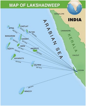
- India’s smallest Union Territory, Lakshadweep is an archipelago consisting of 36 islands with an area of 32 sq km.
Key Points
- Sea Level Rise (SLR):
- SLR is an increase in the level of the world’s oceans due to the effects of climate change, especially global warming, induced by three primary factors: Thermal Expansion, Melting Glaciers and Loss of Greenland and Antarctica’s ice sheets.
- Sea level is primarily measured using tide stations and satellite laser altimeters.
- SLR is Linked to Three Primary Factors:
- Thermal Expansion: When water heats up, it expands. About half of the sea-level rise over the past 25 years is attributable to warmer oceans simply occupying more space.
- Melting Glaciers: Higher temperatures caused by global warming have led to greater-than-average summer melting of large ice formations like mountain glaciers as well as diminished snowfall due to later winters and earlier springs.
- That creates an imbalance between runoff and ocean evaporation, causing sea levels to rise.
- Loss of Greenland and Antarctic Ice Sheets: As with mountain glaciers, increased heat is causing the massive ice sheets that cover Greenland and Antarctica to melt more quickly, and also move more quickly into the sea.
- Rate of SLR:
- Global: Global sea level has been rising over the past century, and the rate has accelerated in recent decades. The average global sea level has risen 8.9 inches between 1880 and 2015. That’s much faster than in the previous 2,700 years.
- Also, Intergovernmental Panel on Climate Change (IPCC) released ‘The Special Report on the Ocean and Cryosphere in a Changing Climate’ in 2019 which underlined the dire changes taking place in oceans, glaciers, and ice-deposits on land and sea.
- Regional: SLR is not uniform across the world. Regional SLR may be higher or lower than Global SLR due to subsidence, upstream flood control, erosion, regional ocean currents, variations in land height, and compressive weight of Ice Age glaciers.
- Global: Global sea level has been rising over the past century, and the rate has accelerated in recent decades. The average global sea level has risen 8.9 inches between 1880 and 2015. That’s much faster than in the previous 2,700 years.
- Consequences of SLR:
- Coastal Flooding: Globally, eight of the world's 10 largest cities are near a coast, which is threatened by coastal flooding.
- Destruction of Coastal Biodiversity: SLR can cause destructive erosion, wetland flooding, aquifer and agricultural soil contamination with salt, and lost habitat for biodiversity.
- Dangerous Storm Surges: Higher sea levels are coinciding with more dangerous hurricanes and typhoons leading to loss of life and property.
- Lateral and Inland Migration: Flooding in low-lying coastal areas is forcing people to migrate to the higher ground causing displacement and dispossession and in turn a refugee crisis worldwide.
- Impact on Infrastructure: The prospect of higher coastal water levels threatens basic services such as internet access.
- Threat to Inland Life: Rising seas can contaminate soil and groundwater with salt threatening life farther away from coasts.
- Tourism and Military Preparedness: Tourism to coastal areas and military preparedness will also be negatively affected by an increase in SLR.
- Steps taken to Tackle SLR:
- Relocation: Many coastal cities have planned to adopt relocation as a mitigation strategy. For example, Kiribati Island has planned to shift to Fiji, while the Capital of Indonesia is being relocated from Jakarta to Borneo.
- Building Sea Wall: Indonesia’s government launched a coastal development project called a Giant Sea Wall or "Giant Garuda" in 2014 meant to protect the city from floods.
- Building Enclosures: Researchers have proposed Northern European Enclosure Dam (NEED), enclosing all of the North Sea to protect 15 Northern European countries from rising seas. The Persian Gulf, the Mediterranean Sea, the Baltic Sea, the Irish Sea, and the Red Sea were also identified as areas that could benefit from similar mega enclosures.
- Architecture to Steer Flow of Water: Dutch City Rotterdam built barriers, drainage, and innovative architectural features such as a "water square" with temporary ponds.
- Vulnerability of India:
- India's 7,516-kilometre-long coastline includes 5,422 kilometres of coastline on the mainland and 2,094 kilometres on the islands belonging to nine states and four Union Territories.
- The coastline accounts for 90% of the country's trade and it spans 3,331 coastal villages and 1,382 islands.
- India’s Efforts:
- Coastal Regulation Zone:
- The coastal areas of seas, bays, creeks, rivers, and backwaters which get influenced by tides up to 500 m from the high tide line (HTL) and the land between the low tide line (LTL) and the high tide line were declared as Coastal Regulation Zone (CRZ) in 1991.
- The latest regulation also takes into account rising sea-levels due to global warming.
- National Action Plan on Climate Change:
- It was launched in 2008 by the Prime Minister's Council on Climate Change.
- It aims at creating awareness among the representatives of the public, different agencies of the government, scientists, industry and the communities on the threat posed by climate change and the steps to counter it.
- Coastal Regulation Zone:
Way Forward
- The Paris Agreement provides a clear vision on limiting global warming and thus, SLR.
- Some of the other steps in this direction would include:
- Switching from fossil fuels to clean alternatives like solar and wind energy.
- Instituting carbon taxes on industries and subsidies for reducing the carbon footprint.
- Carbon sequestration by geo-engineering and natural methods like restoring peatland and wetland areas to capture existing greenhouse gases.
- Afforestation and reducing deforestation.
- Subsidizing research on climate change.


