Important Facts For Prelims
Cape of Good Hope
- 30 Mar 2021
- 2 min read
Why in News
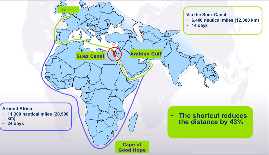
Due to the recent blockage of the Suez Canal, the option of re-routing ships via the Cape of Good Hope was explored.
Key Points
- About:
- The Cape of Good Hope is a rocky headland on the Atlantic coast of the Cape Peninsula in South Africa.
- A headland is a narrow piece of land which sticks out from the coast into the sea.
- The Cape of Good Hope route joins Eastern Asia and Europe to southern parts of Africa.
- The opening of the Suez Canal in 1869 provided a much shorter route from the Mediterranean Sea to the Indian Ocean, making the long trip around Africa inefficient.
- The Cape of Good Hope route is 8900 km longer than the Suez canal route and can take additional two weeks.
- A common misconception is that the Cape of Good Hope is the southern tip of Africa.
- Contemporary geographic knowledge instead states the southernmost point of Africa is Cape Agulhas about 150 km to the east-southeast.
- The warm-water Agulhas current (Indian Ocean) meets the cold-water Benguela current (Atlantic ocean) between Cape Agulhas and Cape Point (about 1.2 km east of the Cape of Good Hope).
- The Cape of Good Hope is a rocky headland on the Atlantic coast of the Cape Peninsula in South Africa.
- History:
- The Cape was originally named the Cape of Storms in 1488 by the Portuguese explorer Bartolomeu Dias.
- It was later renamed to Cape Good Hope to attract more people to the Cape Sea Route that passed the southern coast of Africa.
- The Cape eventually became a significant port and waypoint for sailors traveling from Europe to Asia.