Geography
Erosion in Ladakh and Zanskar
- 01 May 2020
- 5 min read
Why in News
The scientists and students from the Wadia Institute of Himalayan Geology (WIHG) have explored the Zanskar catchment area.
- The study was conducted to understand the landform evolution in transitional climatic zones, using morphostratigraphy, Optically Stimulated Luminescence (OSL) dating and provenance analysis of landforms like valley fill terraces and alluvial fans.
- Valley Fill Terrace: The fill terrace is created either a stream or river starts to incise into the material that it deposited in the valley. Once this occurs benches composed completely of alluvium form on the sides of the valley. The upper most benches are the fill terraces.
- Alluvial Fans: Triangle-shaped deposit of gravel, sand and even smaller pieces of sediment, such as silt.
- WHIG is an autonomous institute under the Department of Science & Technology, Government of India.
Zanskar River
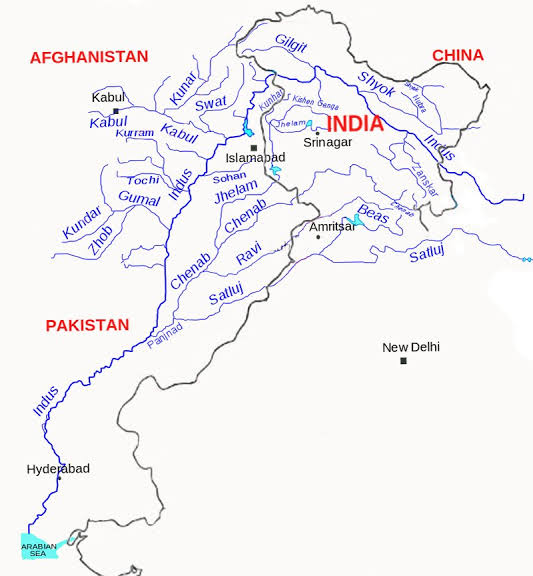
- It is one of the largest tributaries of the upper Indus catchment.
- It drains transversely northward from the Higher Himalaya, dominated by the Indian summer monsoon, to flow through the arid, westerlies-dominated, highly folded and thrusted Zanskar ranges in Ladakh.
- The Doda and the Tsarap Lingti Chu confluence at Padam to form the Zanskar, which in turn joins the Indus at Nimu.
- Zanskar valley can be divided into upper and lower divisions, separated by a gorge of nearly 60 km in length.
Morphostratigraphy: The organization of rock or sediment strata into units based on their surface morphology (landforms).
Optically-Stimulated Luminescence: It is a late Quaternary dating technique used to date the last time a quartz sediment was exposed to light. As sediment is transported by wind, water or ice, it is exposed to sunlight and zeroed of any previous luminescence signal.
Provenance Analysis: It aims to determine the source region (provenance) of a sediment sample. It is aimed to reconstruct the parent rock or rocks of sand bodies, the time of deposition of the sand and, if possible, the climate conditions during the formation of the sediments.
Key Findings
- Scientists traced where the rivers draining Himalaya and its foreland erode the most and identified the zones which receive these eroded sediments and fill up.
- The study suggested that the wide valley of Padam in the upper Zanskar is a hotspot of sediment buffering and has stored a vast amount of sediments.
- The sediment contribution from such transient basins is significant when compared to the sediment reportedly eroded from the entire Indus system in Ladakh.
- Most of the sediments in the Padam valley were derived from Higher Himalayan crystalline that lie in the headwater region of Zanskar.
- The dominant factors responsible for sediment erosion were deglaciation and Indian Summer Monsoon derived precipitation in the headwaters.
- The provenance analysis suggested that despite the presence of the deep narrow gorge and a low gradient, the upper and lower Zanskar valleys remained connected throughout their aggradational history.
Significance
- The study will help to understand river-borne erosion and sedimentation, which are the main drivers that make large riverine plains, terraces and deltas that eventually become the evolving grounds for civilizations.
- The study brought forwards the 35 thousand-year history of river erosion and identified hotspots of erosion and wide valleys that act as buffer zones.
- It showed how rivers in drier Ladakh Himalaya operated on longer time scales and how they responded to varying climates.
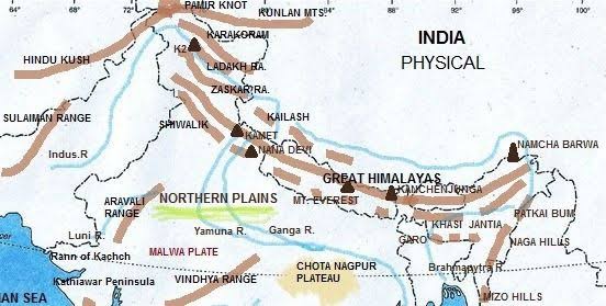
- The Ladakh Himalaya forms a high altitude desert between Greater Himalayan ranges and Karakoram Ranges and the Indus and its tributaries are major rivers flowing through the terrain.
- Understanding of water and sediment routing becomes crucial while developing infrastructure and for other development works in the river catchment area.


