Biodiversity & Environment
Strengthening Himalayan Disaster Preparedness
- 18 Sep 2025
- 14 min read
This editorial is based on “ A future-ready disaster management in the Himalaya requires a massive technology scale-up” which was published in The Indian Express on 18/09/2025. The article highlights that as climate-induced disasters rise in the Himalayas, India must move beyond strong disaster response towards technological upgrades, scientific monitoring, and community preparedness for long-term resilience.
For Prelims: Indian Himalayan Region (IHR), Kanchenjunga, Valley of Flowers National Park, Nanda Devi National Park, Glacial Lake Outburst Floods (GLOFs), Gangotri Glacier, National Mission for Sustaining the Himalayan Ecosystem (NMSHE), Indian Himalayas Climate Adaptation Programme (IHCAP), SECURE Himalaya Project, The Chipko Movement
For Mains: Key Reasons Behind the High Disaster Risk in the Himalayas, Key Strategies to Enhance Disaster Preparedness and Risk Reduction in the Indian Himalayas
The Indian Himalayan Region, with its awe-inspiring landscapes, is also one of the most disaster-prone regions in India. This fragile mountain ecosystem faces a cascading risk of climate-induced and geophysical disasters. Recent catastrophic events like the 2025 devastating floods in Dehradun, cloudbursts in Uttarkashi coupled with ongoing challenges such as unplanned urbanization, fragile infrastructure, deforestation, and climate change, demand a transformative and future-ready disaster management approach.
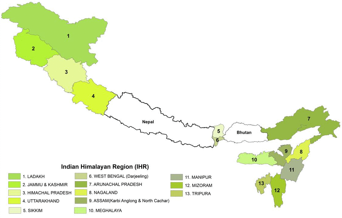
What is The Indian Himalayan Region (IHR)?
- About:
- It refers to the mountainous area in India that encompasses the entire Himalayan range within the country.
- The Indian Himalayan Region is spread across 13 Indian States/Union Territories (namely Jammu and Kashmir, Ladakh, Uttarakhand, Himachal Pradesh, Arunachal Pradesh, Manipur, Meghalaya, Mizoram, Nagaland, Sikkim, Tripura, Assam and West Bengal), stretching across 2500 km.
- Significance:
- The IHR encompasses some of the world's highest peaks, such as Kanchenjunga.
- Known as India's "water tower," the IHR is the source of many major rivers, including the Ganges, Yamuna, Brahmaputra, and their tributaries.
- The region plays a crucial role in regulating the ecological balance and maintaining biodiversity.
- The region hosts rich biodiversity, including the snow leopard, red panda, Himalayan monal, and medicinal plants like Yarsagumba and Rhododendron arboreum.
- It includes several national parks, wildlife sanctuaries, and biosphere reserves, such as the Valley of Flowers National Park and Nanda Devi National Park.
- The IHR influences the climate and weather patterns of the Indian subcontinent, acting as a barrier to cold winds from Central Asia and affecting monsoon patterns.
- The region is inhabited by diverse ethnic communities with unique cultures, languages, and traditions.(Ladakhis, Bhutias of Sikkim, Tibetan Buddhist influence, Gaddis of Himachal Pradesh)
- It includes important religious and pilgrimage sites for various faiths, such as Amarnath, Badrinath, etc.
- The IHR holds strategic importance due to its location along India's northern borders with China, Nepal, and Bhutan.
What are the Key Reasons Behind the High Disaster Risk in the Himalayas?
- Geological Fragility and Seismic Activity: The Himalayas are among the youngest mountain ranges on Earth, formed by the ongoing collision of the Indian and Eurasian tectonic plates.
- This makes the region highly seismically active, with frequent earthquakes triggering landslides, avalanches, and flash floods.
- Major fault lines such as the Dhaulagiri and Indus-Ganga faults, located in Seismic Zones IV and V, absorb tectonic stress that, when released suddenly, devastates surrounding areas.
- Historical examples include the 2005 Kashmir Earthquake (Magnitude 7.6) and the 2013 Kedarnath disaster, while recent events in Uttarakhand and Sikkim (2025) demonstrate how geological instability continues to produce cascading disasters.
- Accelerated Climate Change Impact: The Himalayas are warming at twice the global average, accelerating glacial melt and the expansion of glacial lakes, which can trigger Glacial Lake Outburst Floods (GLOFs).
- In 2023, Sikkim’s GLOF damaged the Teesta hydroelectric project, highlighting climate-driven threats.
- Erratic and extreme monsoon rainfall, such as the record precipitation in Dehradun (2025), has caused unprecedented floods, soil erosion, and slope destabilization, compounding disaster risk.
- Dehradun recorded its highest rainfall in 101 years, triggering massive floods, landslides, and the destruction of homes and roads.
- Unplanned and Unsustainable Development: Infrastructure expansion, hydropower projects, tourism, and construction in ecologically fragile zones destabilize slopes and increase vulnerability.
- The 2025 Dharali flash flood exemplifies how unregulated development amplifies disaster impact.
- In Uttarakhand's Dharali village, a devastating flash flood deposited 12–18 meters of sediment, engulfing large parts of the village
- Similarly, the Joshimath land subsidence crisis (2023) highlighted the dangers of unchecked construction and overburdened slopes in fragile Himalayan terrain
- Some critics argue that projects like Char Dham and construction in floodplains exacerbate erosion, deforestation, and glacial stress.
- Inadequate Early Warning and Monitoring Systems: Despite technological advances, the Himalayan region lacks comprehensive real-time hazard monitoring.
- Early warning for floods, landslides, and GLOFs remains patchy, particularly in remote areas.
- Punjab Floods, 2025 saw the Ravi, Beas and Sutlej rivers swell dangerously with record inflows at Bhakra and Pong dams.
- The absence or delay of alerts during the 2025 Uttrakhand flash floods limited evacuation time, underscoring the need for AI-based predictive models, drones, and automated sensors.
- Early warning for floods, landslides, and GLOFs remains patchy, particularly in remote areas.
- Socioeconomic and Institutional Vulnerabilities: Many Himalayan communities are marginalized, remote, and resource-constrained, limiting their preparedness and resilience.
- The rise in disaster-related deaths in Uttarakhand (2025) reflects gaps in institutional coordination, capacity building, and healthcare access during emergencies.
- Governance challenges across multiple administrative layers further complicate rapid, coordinated disaster response.
What are the Key Government Initiatives to Mitigate Disaster Risks in the Indian Himalayan Region?
- National Disaster Management Authority (NDMA): The National Disaster Management Plan (NDMP) has been revised to prioritize Himalayan-specific hazards, including landslides, GLOFs, floods, and earthquakes.
- Emphasis is on hazard risk mapping, inter-agency coordination, and community engagement.
- Enhanced State Disaster Response Fund (SDRF): Central government contribution to the Himalayan states is 90%, higher than 75% for general states, ensuring rapid disaster relief and rehabilitation.
- Technology-Driven Monitoring and Early Warning Systems: ISRO and the National Remote Sensing Centre (NRSC) conduct satellite-based monitoring of glacial lakes, unstable slopes, and river systems.
- Innovations include solar-powered automated sensors, drone surveillance, AI-enabled forecasting, GIS-based risk mapping, and IMD nowcasting.
- Mission Mausam and related programs enhance radar networks, rain gauges, and model resolution for more accurate predictions.
- Community-Led Disaster Management Systems (DMS-Himalaya): Local communities are trained in pre-disaster preparedness, hazard mapping, and post-disaster response.
- The model empowers locally trained disaster response teams supported by technology-aided communication networks, aiming to cover 900,000 people.
- Initiatives promote inclusive capacity building in schools, panchayats, and local governance structures.
- Regional and International Cooperation: The Hindu Kush Himalayan Disaster Risk Reduction Hub (2024) at Kathmandu, facilitates transboundary data sharing, harmonized early warning systems, and climate-resilient research.
- Collaboration spans India, Nepal, Bhutan, China, and other Himalayan nations, focusing on impact-based forecasting and policy guidance.
Additional Programs Supporting Himalayan Resilience:
What Measures can be Adopted to Enhance Disaster Risk Management in the Himalayan Region?
- Sustainable Infrastructure and Land-Use Planning: Enforce strict zoning regulations to prohibit construction on floodplains, unstable slopes, and ecologically sensitive areas.
- Complete ban on construction activities in disaster-prone areas as suggested by the Mishra Committee,1976.
- Develop land use plans that clearly demarcate zones for conservation, agriculture, residential, and industrial activities.
- For instance, Western Ghats Ecology Expert Panel (WGEEP), also known as the Gadgil Committee, recommended a zoning system for the Western Ghats to balance conservation and development needs.
- A similar approach can also be applied to the Himalayan region.
- Adopt environmental impact assessments (EIAs) customized for Himalayan geology, hydrology, and climate variability.
- Revise the National Building Code for hill regions to mandate earthquake-resistant and landslide-resilient designs.
- Technology-Driven Early Warning Systems: Deploy solar-powered automated sensors, satellite monitoring, and drones at glacial lakes and landslide-prone slopes for real-time hazard detection.
- Integrate AI and GIS-based predictive models to forecast flash floods, cloudbursts, and debris flows with higher accuracy.
- Replicate successful models like the Gorakhpur urban flood control system for localized hazard management.
- Community-Based Disaster Management (CBDM): Institutionalize participatory hazard mapping, first responder training, and community shelters equipped with disaster supplies.
- Expand the reach of programs like NDMA’s Aapda Mitra, covering schools, panchayats, and resident welfare associations.
- Empower local communities to manage and protect forest resources through joint forest management programs.
- The Chipko Movement was a grassroot forest conservation effort where local women hugged trees to prevent their felling, demonstrating the power of community action.
- Strengthened Inter-Agency and Regional Coordination: Enhance coordination between NDMA, state disaster authorities, meteorological departments, scientific institutions, and local governance.
- Foster transboundary collaboration via platforms like the Hindu Kush Himalayan Disaster Risk Reduction Hub.
- Recovery, Reconstruction, and “Build Back Better”: Reconstruct roads and infrastructure with slope stabilization and hazard-resilient designs.
- Reinforce river embankments, regulate mining, and restore degraded landscapes.
- Ensure continuous monitoring, research, and policy adaptation to evolving climatic and geological risks.
- A report of the High-Level Expert Group (HLEG) on Himalayan Glaciology emphasized the need for monitoring Himalayan glaciers, assessing their health, and understanding their role in regional water resources.
- Reinforce river embankments, regulate mining, and restore degraded landscapes.
Conclusion
A resilient Himalayan future demands combining technology, community preparedness, and ecological safeguards, guided by visionary recommendations of the Mishra (1976) and J.C. Pant (1999) Committees on construction norms, disaster governance, and capacity building. Together, these measures can shift India from reactive relief to proactive, long-term disaster resilience.
|
Drishti Mains Question: Q. Examine the key factors contributing to frequent disasters in the Indian Himalayan Region. Suggest effective measures to enhance disaster resilience and preparedness in this fragile ecosystem. |
UPSC Civil Services Examination, Previous Year Questions (PYQs)
Prelims
Q. When you travel in the Himalayas, you will see the following: (2012)
- Deep gorges
- U-turn river courses
- Parallel mountain ranges
- Steep gradients causing land sliding
Which of the above can be said to be the evidence for Himalayas being young fold mountains?
(a) 1 and 2 only
(b) 1, 2 and 4 only
(c) 3 and 4 only
(d) 1, 2, 3 and 4
Ans: (d)
Mains
Q.Bring out the causes for more frequent landslides in the Himalayas than in Western Ghats. (2013)
Q.Describe the various causes and the effects of landslides. Mention the important components of the National Landslide Risk Management Strategy. (2021)
Q. Vulnerability is an essential element for defining disaster impacts and its threat to people. How and in what ways can vulnerability to disasters be characterized? Discuss different types of vulnerability with reference to disasters. (2019)


