Place In News
Popocatépetl Volcano
- 07 Jan 2026
- 2 min read
A National Autonomous University of Mexico (UNAM) has produced the first 3D seismic image of the internal structure of Mexico’s Popocatépetl volcano, improving understanding of magma movement and eruption behaviour in a high-risk volcanic zone.
- Artificial Intelligence and machine learning algorithms were used to classify and analyse seismic signals (tremors). The imaging reveals multiple magma reservoirs at different depths (up to 18 km below the crater) rather than a single magma chamber.
- The volcano functions as a “natural laboratory”, helping scientists refine models of volcanism, magma dynamics, and hazard mitigation.
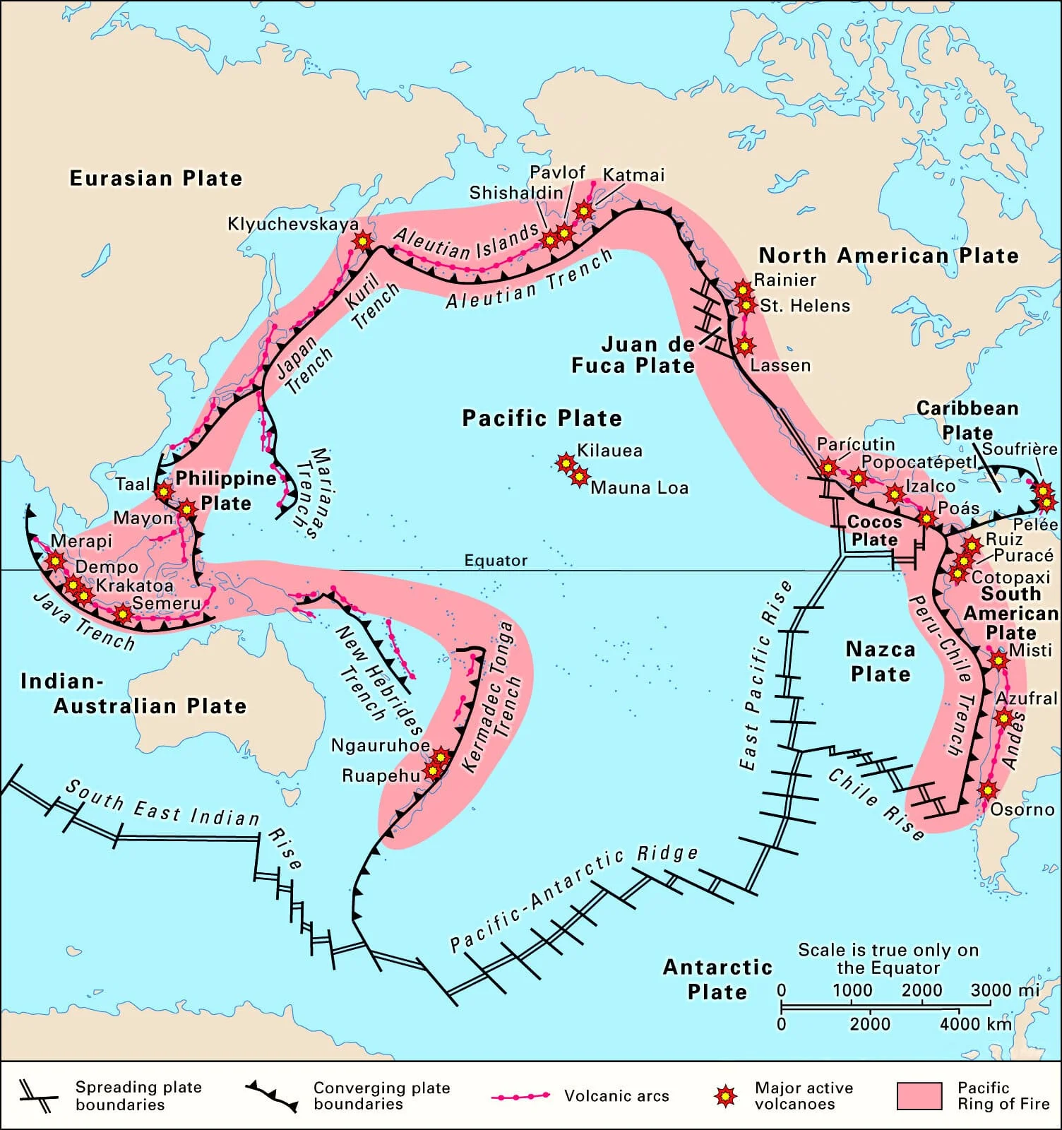
- Popocatépetl Volcano: Also known as “Smoking Mountain”, it is a steep-sided stratovolcano in central Mexico, located on the border of the states of México and Puebla.
- It lies on the Trans-Mexican Volcanic Belt, formed due to the subduction of the Cocos Plate beneath the North American Plate.
- Rising to an elevation of 5,452 m above sea level, Popocatépetl is Mexico’s second-highest volcano after Pico de Orizaba, and is one of the country’s most active and dangerous volcanoes, with recorded eruptions since 1519, forming part of the Pacific Ring of Fire.
- The Pacific Ring of Fire, or Circum-Pacific Belt, is a horseshoe-shaped zone of intense seismic and volcanic activity around the Pacific Ocean, accounting for ~75% of active volcanoes and ~90% of earthquakes worldwide.
| Read more: Pacific Ring of Fire |


