Rapid Fire
NISAR and Synthetic Aperture Radar
- 18 Jun 2025
- 2 min read
The NASA-ISRO SAR (NISAR) satellite has arrived at ISRO’s spaceport in Sriharikota for launch and will scan nearly all land and ice surfaces twice every 12 days, delivering unprecedented data on Earth’s environment.
- About NISAR Mission: It is a collaborative Earth-observation mission between NASA (US) and ISRO (India), aimed at studying Earth’s land and ice surfaces in unprecedented detail.
- It integrates two advanced radar systems—NASA’s L-band radar and ISRO's S-band radar—marking it as the first satellite to carry both.
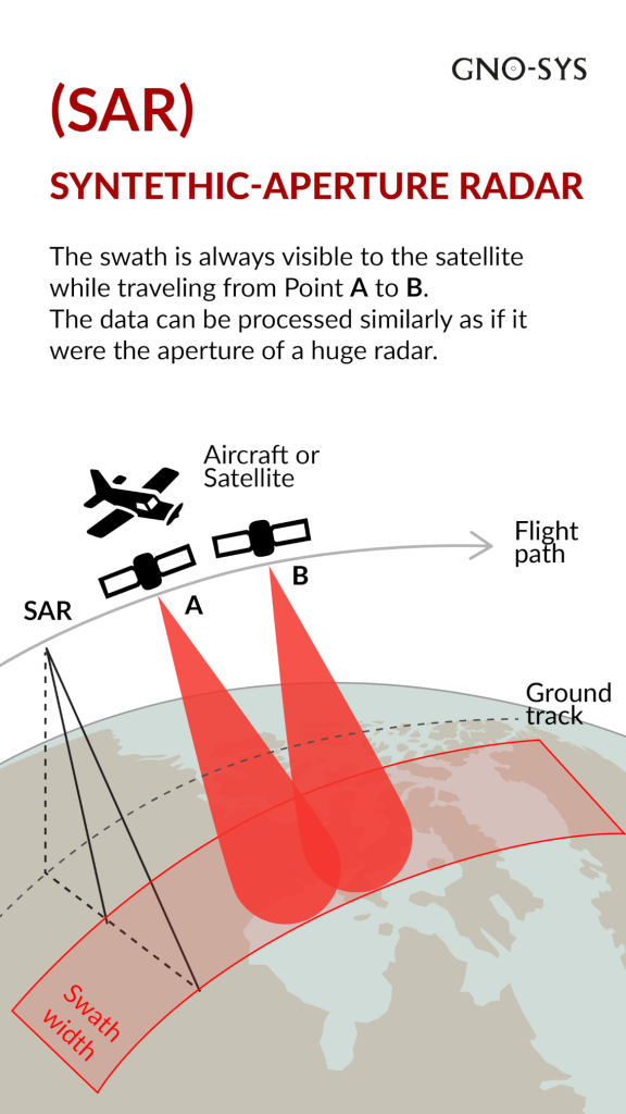
- About Synthetic Aperture Radar (SAR): SAR is an active remote sensing technology that transmits microwave pulses and records echoes to create images.
- Unlike optical cameras (which rely on sunlight), SAR works day and night and in all weather conditions, as microwaves penetrate clouds, smoke, and light rain.
- Working of SAR: SAR sends microwave pulses and records echoes from Earth’s surface, using platform movement (e.g., satellite or aircraft) to simulate a large antenna and produce high-resolution images.
- Applications of SAR:
- Environmental monitoring: Mapping wetlands, tracking oil spills in marshes.
- Cryosphere studies: Monitoring icebergs and ice sheets (e.g., Antarctica).
- Disaster management: Detecting floods, landslides, and changes in terrain.
- Agriculture & forestry: Assessing soil moisture, vegetation health, and deforestation.
| Read More: NISAR Satellite |


