Science & Technology
Flood Hazard Atlas
- 24 Jun 2019
- 2 min read
Odisha has released a unique flood hazard atlas on the basis of historic flood inundation captured through satellite imagery over the period from 2001 to 2018.
- Flooding in Odisha: Vast areas of the state are inundated when there is flooding every year in major rivers like the Mahanadi, Brahmani, Baitarani, Subarnarekha and Rushikulya.
- Some of the rivers like the Vamsadhara and Budhabalanga, also cause flash floods due to instant run-off from their hilly catchments.
Flood Hazard Atlas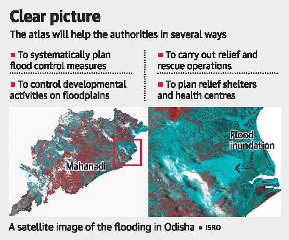
- It is the mapping and zonation of an area prone to frequent flooding, the mapping is done on the basis of the data of the past few years. The National Remote Sensing Centre (NRSC) of the Indian Space Research Organisation (ISRO), Hyderabad does flood hazard zonation.
Benefits of Flood Hazard Atlas
- Better preparedness: A more concise focus on the effects and impacts of the flooded area is possible during the early planning stages.
- Risk reduction or mitigation techniques can be recommended for the same portion of the study area.
- Location, severity, or frequency of hazard can be done more easily.
- Proper assessment of area: A study area or a sub-area can be expanded, reduced, or deleted. Study areas can be divided into sub-areas requiring more information, additional assessments, or specific reduction techniques.
- Risk evaluation: A more realistic evaluation of risks to new development is possible. Appropriate hazard reduction techniques can be more easily developed to deal with an emergency situation.
- Rehabilitation planning: It could be initiated in advance with proper coordination among different central and state agencies.


