Geography
Shift in Earth's Magnetic North Pole
- 16 Jan 2019
- 3 min read
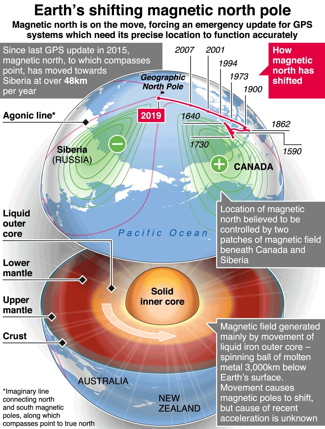
- British Geological Survey has reported that the earth’s magnetic north pole is moving from its current position in Canada to Siberia.
- The shift is causing geophysicists to reconsider the world magnetic model which is used for navigation purposes.
- The World Magnetic Model (WMM) is a standard model of the core and large-scale crustal magnetic field.
- It is used extensively for navigation by the United Kingdom and the US for Defence purposes, the North Atlantic Treaty Organization (NATO) and the International Hydrographic Organization (IHO). It is also used widely in civilian navigation and heading systems.
- The Magnetic model which is updated at every five years and was supposed to be updated in 2020, but due to the unexpected shift, it has been preponed to January 30, 2019.
- Scientists think that reason for such shift is geomagnetic pulses beneath South America and the high-speed jet of liquid iron beneath Canada.
Geographical Poles vs. Magnetic Poles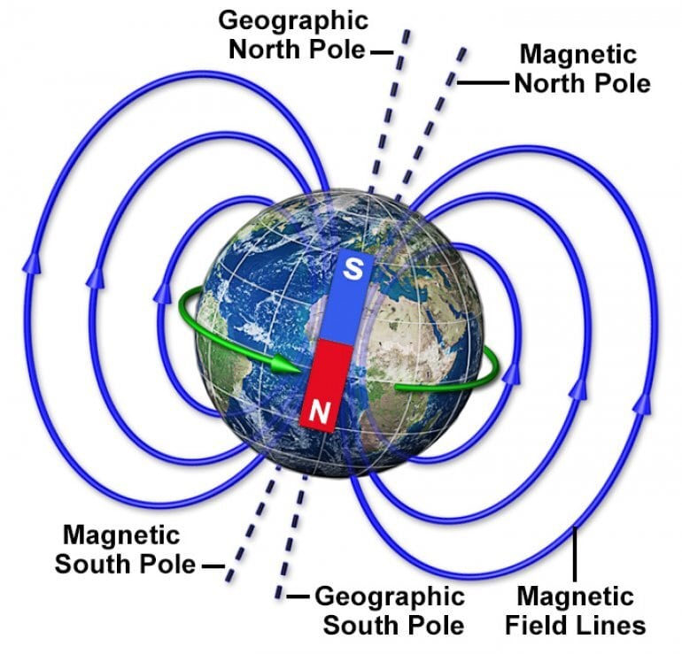
- Geographic Poles
- The Earth rotates on the geographic north and south poles. The geographic north and south poles are where lines of longitude (meridians) converge in the north. The south and north pole are directly opposite to one another.
- Magnetic North PoleThe Earth acts as one big magnet.
- The Earth consists of a solid iron core. Surrounding the iron core is an ocean of hot, liquid metal.
- The liquid metal that flows in Earth’s core creates electrical currents, which in turn creates our magnetic field.
- The Magnetic North Pole (also known as the North Dip Pole) is a point on Ellesmere Island in Northern Canada where the northern lines of attraction enter the Earth.
- This means that a compass needle point to the Magnetic North Pole – which is different from the geographic north.
International Hydrographic Organization
- The International Hydrographic Organization is an intergovernmental consultative and technical organization that was established in 1921 to support the safety of navigation and the protection of the marine environment.
- India is also a member of IHO.
- The objective of the Organization is to bring about:
- The coordination of the activities of national hydrographic offices
- The greatest possible uniformity in nautical charts and documents
- The adoption of reliable and efficient methods of carrying out and exploiting hydrographic surveys
- The development of the sciences in the field of hydrography and the techniques employed in descriptive oceanography


