Science & Technology
Sentinel-6 Satellite: Jason-CS Mission
- 24 Nov 2020
- 3 min read
Why in News
Recently, Copernicus Sentinel-6 Michael Freilich satellite was launched from the Vandenberg Air Force base in California aboard a SpaceX Falcon 9 rocket.
Key Points
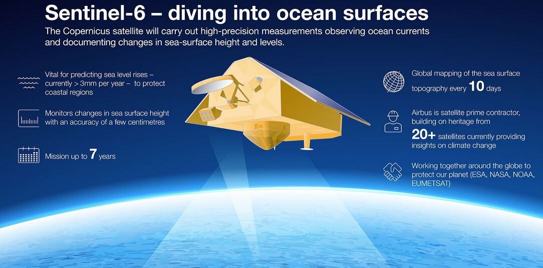
- Jason-CS Mission: Sentinel-6-Satellite is a part of the mission dedicated to measuring changes in the global sea level. The mission is called the Jason Continuity of Service (Jason-CS) mission.
- Objective of the Mission: To measure the height of the ocean, which is a key component in understanding how the Earth’s climate is changing.
- Components: It consists of two satellites, Sentinel-6 and the other, called Sentinel-6B, to be launched in 2025.
- Joint collaboration of: The European Space Agency (ESA), National Aeronautics and Space Administration (NASA), European Organisation for the Exploitation of Meteorological Satellites (Eumetsat), the USA’s National Oceanic and Atmospheric Administration (NOAA) and the European Union (EU), with contributions from France’s National Centre for Space Studies (CNES).
- Mechanism:
- The satellite will send pulses to the Earth’s surface and measure how long they take to return to it, which will help in measuring the sea surface height. It will also measure water vapour along this path and find its position using GPS and ground-based lasers.
- As per NASA, this will help in monitoring critical changes in ocean currents and heat storage only from space, by measuring height of the sea surface.
- This will in turn help in foreseeing the effects of the changing oceans on the climate.
- Significant in:
- Ensuring the continuity of sea-level observations.
- Understanding how the ocean stores and distributes heat, water and carbon in the climate system.
- Supporting operational oceanography, by providing improved forecasts of ocean currents, wind and wave conditions.
- Improving both short-term forecasting for weather predictions, and long term forecasting for seasonal conditions like El Niño and La Niña.
- Other satellites (joint mission of NASA and CNES) that have been launched since 1992 to track changes in the oceans on a global scale include the TOPEX/Poseidon, Jason-1 and OSTN/Jason-2, among others.


