Jharkhand
Jharkhand Public Service Commission (JPSC) GK
- 09 Aug 2021
- 13 min read
Last Updated: May 2024
JHARKHAND GK
| Formation | 15 November, 2000 |
| Capital | Ranchi |
| Population | 3,29,88,134 |
| Area | 79,710 Sq. km. |
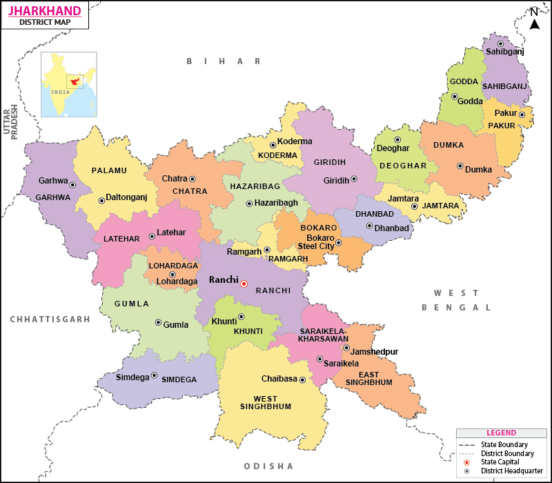
| Total District | 24 |
| High Court | Ranchi |
| State Symbol | |||
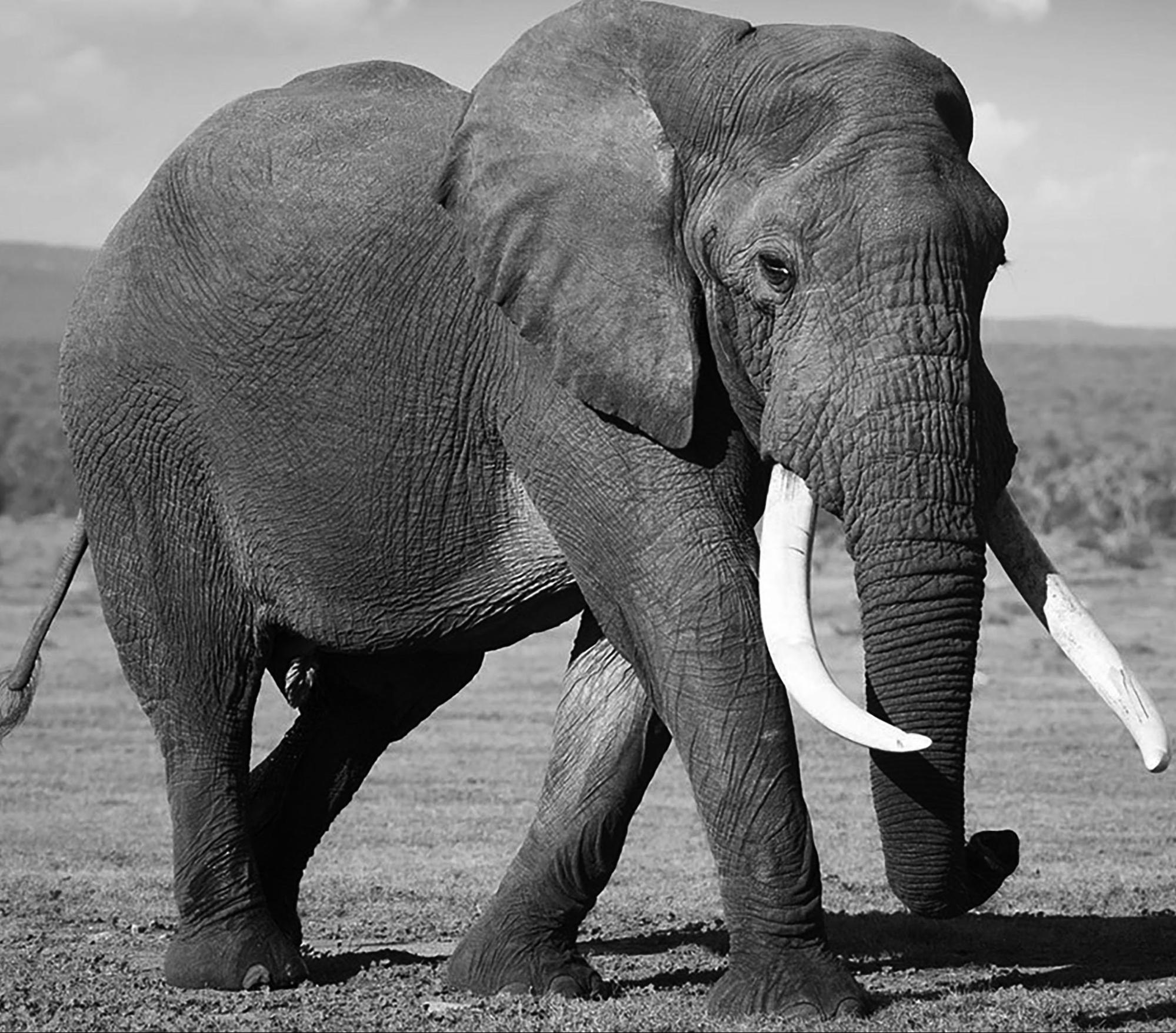
| State Animal: Elephant |
 |
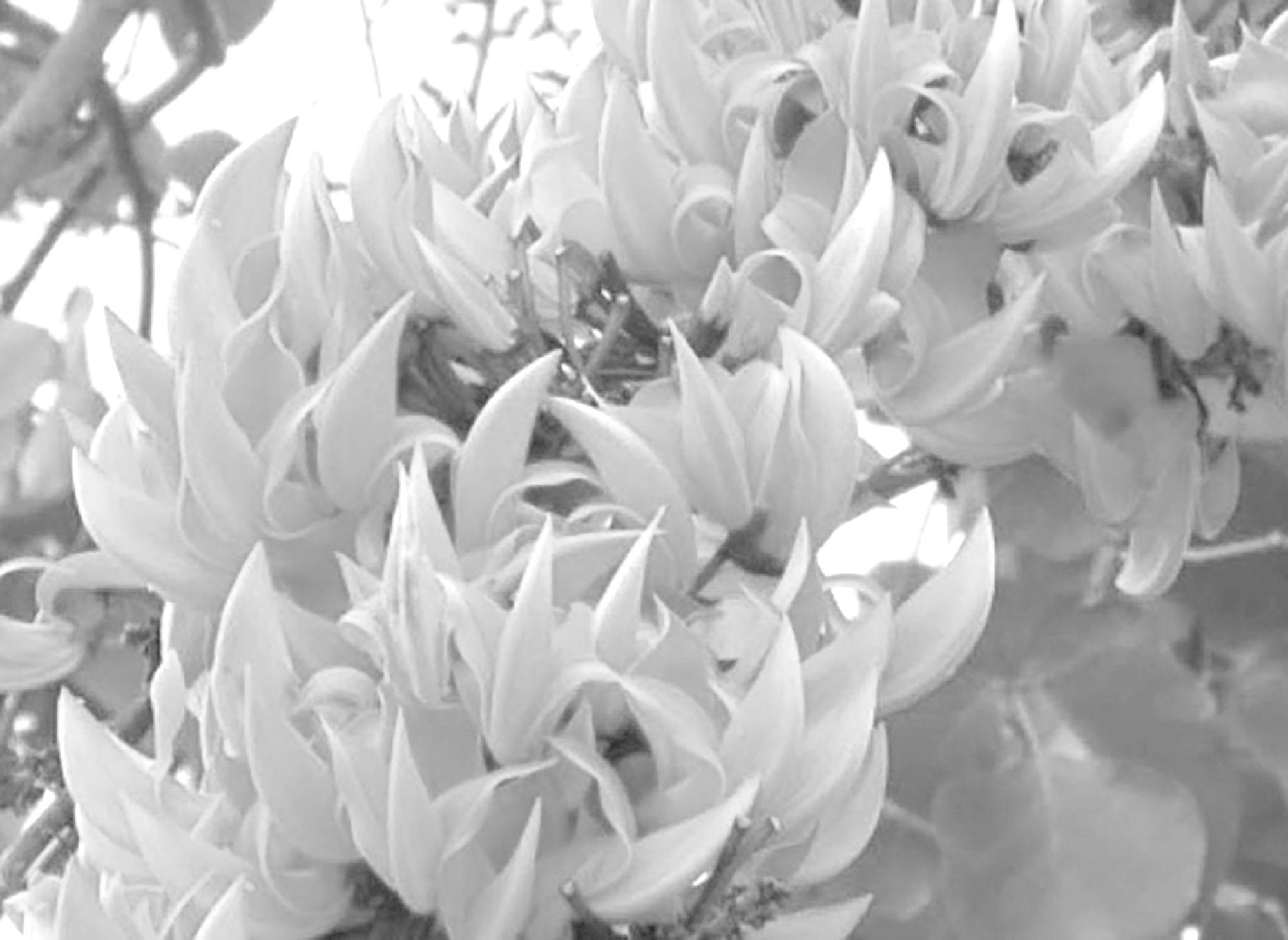
State Flower: Plash |
 |
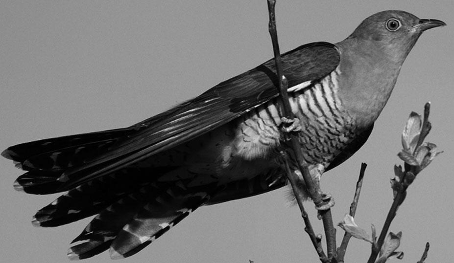
| State Bird: Koel or Cuckoo |
 |
State Tree: Sal |
 |
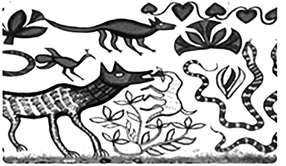
| Main folk art of Santhal tribe: Jadopatia |
 |
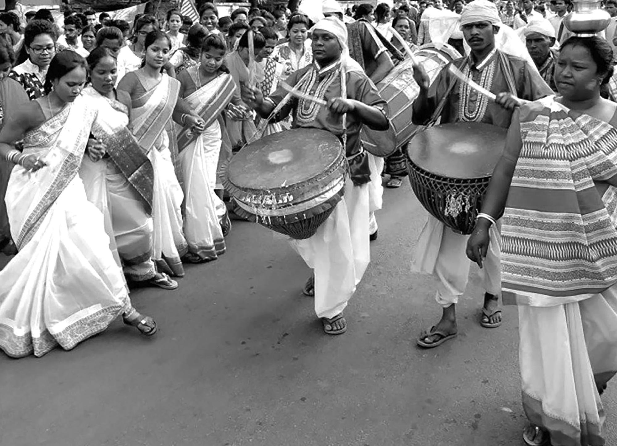
Tribal Festival: Sarhul |
 |
Jharkhand : General Introduction
| Jharkhand : At a Glance | |
| Official name of the state | Jharkhand |
| Established | 15 November, 2000 |
| Foundation Day | 15 November |
| Capital | Ranchi |
| Sub-Capital | Dumka |
| High Court | Ranchi |
| Official Language | Hindi |
| Second Official Language | Urdu |
| Other Languages | Santhali, Bangla, Mundari, Kudukh, Ho, Nagpuria, Khortha, Panchpargania |
| State Symbol | |
| State Animal | Elephant (Scientific Name: Elephas Maximus Indicus) |
| State Bird | Koel (Scientific Name: Eudynamys Scolopaceus) |
| State Tree | Sal (Scientific Name: Shorea robusta) |
| State Flower | Plash (Scientific Name: Butea monosperma) |
| Emblem of the State | Jharkhand's new emblem has a circular shape, indicating a symbol of development |
| Geographical and Administrative Introduction | |
| Geographical Location | The north-east part of India |
| Latitudinal Extension | 21º 58' N to 25º 18' N |
| Longitudinal Extension | 83º 22' E to 87º 57'' E |
| Geometric shape of the state | Quadrilateral |
| State's share in the total geographical area of India | 2.42 Percentage |
| State Length (North to South) | 380 Km. |
| State Width (East to West) | 463 Km. |
| Number of states adjoining the state | 5 (Bihar, Odisha, West Bengal, Chhattisgarh, Uttar Pradesh) |
| Number of Districts in the State | 24 |
| Districts of Jharkhand adjoining Bihar | 10 (Sahibganj, Godda, Dumka, Deoghar, Giridih, Koderma, Hazaribagh, Chatra, Palamu, Garhwa) |
| Districts of Jharkhand adjoining Uttar Pradesh | 1 (Garhwa) |
| Districts of Jharkhand adjoining Chhattisgarh | 4 (Garhwa, Latehar, Gumla, Simdega) |
| Districts of Jharkhand adjoining Odisha | 4 (Simdega, West Singhbhum, Seraikela-Kharsawan, East Singhbhum) |
| Districts of Jharkhand adjoining West Bengal | 10 (East Singhbhum, Seraikela-Kharsawan, Ranchi, Ramgarh, Bokaro, Dhanbad, Jamtara, Dumka, Pakur, Sahibganj) |
| The westernmost district of the state | Garhwa |
| The northernmost district of the state | Sahibganj |
| The southernmost district of the state | West Singhbhum |
| State's position in the country in terms of area | 15th |
| Number of Divisions | 05 (North Chotanagpur, South Chotanagpur, Santhal Parganas, Palamu, Kolhan) |
| Largest Divisions (Area) | North Chotanagpur |
| Smallest Divisions (Area) | Palamu |
| Largest District (Area) | West Singhbhum |
| Smallest District (Area) | Ramgarh |
| State's Climate | Monsoon (Tropical Monsoon) |
| Average Annual Rainfall | 140 cm. |
| Major Crop | Paddy |
| Maximum Temperature | 38ºC (90ºF) |
| Minimum Temperature | 10ºC (50ºF) |
| Total Forest Area | 23,553 Sq. Km. (29.55%) |
| Total Subdivisions | 43 |
| Total Blocks | 260 |
| Total Municipal Corporations | 5 (Ranchi, Dhanbad, Deoghar, Chas and Jamshedpur) |
| Total District Councils | 24 |
| Number of members of district councils | 445 |
| Total Panchayat | 4,423 |
| Number of landlocked districts (not adjacent to another state) | (2) Lohardaga, Khunti |
| Number of districts adjoining two states | (5) Sahibganj, Dumka, (Bihar and West Bengal), Simdega (Chhattisgarh and Odisha), Seraikela-Kharsawan, East Singhbhum (Odisha and West Bengal) |
| Number of districts adjoining three states | (1) Garhwa (Bihar, Uttar Pradesh, Chhattisgarh) |
| Total Length of National Highways | 3,184 Km. |
| Total Length of State Highways | 6,880 Km. |
| Number of Universities and Equivalent Institutions | 12 |
| Number of Medical Colleges | 06 |
| Number of Central Universities | 01 |
| Number of Engineering Colleges | 04 |
| Number of Model Schools in the State | 11 |
| Political Introduction of Jharkhand | |
| State legislature | Unicameral (assembly) |
| Total number of members in the Legislative Assembly | 82 |
| Number of elected members in the Legislative Assembly | 81 |
| Nominated members of the Legislative Assembly | 01 |
| Number of seats reserved for Scheduled Tribes in the Legislative Assembly | 28 |
| Number of seats reserved for Scheduled Castes in the Legislative Assembly | 09 |
| Number of unreserved seats in the assembly | 44 |
| Number of Members in Lok Sabha | 14 |
| Number of members in Rajya Sabha | 06 |
| Number of seats reserved for Scheduled Tribes in Lok Sabha | 05 |
| Number of seats reserved for Scheduled Castes in Lok Sabha | 01 |
| Number of unreserved seats in Lok Sabha | 08 |
| Largest parliamentary constituency | West Singhbhum |
| Smallest parliamentary constituency | Chatra |
| Number of valid STs | 32 |
| Number of primitive tribes | 08 |
| Jharkhand Census-2011 | |
| Total population | 3,29,88,134 |
| Male population | 1,69,30,315 |
| Female population | 1,60,57,819 |
| Share of males in the total population | 51.32% |
| Share of women in total population | 48.68% |
| Percentage of population aged 0–6 in the population | 16.33% |
| Scheduled tribes population | 86,45,042 |
| Scheduled tribes population (in Percentage) | 26.2% |
| Scheduled castes population | 39,85,644 |
| Scheduled castes population (in Percentage) | 12.8% |
| Growth rate of population in the decade 2001–2011 | 22.4% |
| District with the highest population growth rate in the decade 2001–2011 | Koderma (43.42%) |
| District with lowest population growth rate in the decade 2001–2011 | Dhanbad (11.99%) |
| First five districts with highest decadal population growth rate | Koderma, Chatra, Latehar, Giridih, Pakur |
| First five districts with lowest decadal population growth rate | Dhanbad, Ramgarh, East Singhbhum, Bokaro, Simdega |
| Total literacy rate of Jharkhand | 66.41% |
| Male literacy rate | 76.84% |
| Female literacy rate | 53.56% |
| District with highest literacy rate | Ranchi (76.06%) |
| District with lowest literacy rate | Pakur (48.82%) |
| First five districts with highest literacy rate | Ranchi, East Singhbhum, Dhanbad, Ramgarh, Bokaro |
| First five districts with lowest literacy rate | Pakur, Sahibganj, Godda, P. Singhbhum, Latehar |
| District with highest male literacy rate | Ranchi (84.26%) |
| 5 districts with highest male literacy rate | Ranchi, Dhanbad, East Singhbhum, Bokaro, Ramgarh |
| 5 districts with lowest male literacy rate | Pakur, Sahibganj, Godda, Chatra, Latehar |
| District with highest female literacy rate | Ranchi (67.44%) |
| District with lowest female literacy rate | Pakur (40.25%) |
| First five districts with highest female literacy rate | Ranchi, East Singhbhum, Dhanbad, Ramgarh, Bokaro |
| First five districts with lowest female literacy rate | Pakur, Sahibganj, Godda, West Singhbhum, Garhwa |
| Sex ratio | 948 (females per 1000 men) |
| District with highest sex ratio | West Singhbhum |
| District with lowest sex ratio | Dhanbad |
| First five districts with highest sex ratio | West Singhbhum, Simdega, Khunti, Gumla, Pakur |
| First five districts with lowest sex ratio | Dhanbad, Ramgarh, Bokaro, Deoghar, Palamu |
| Rural population | 2,50,55,073 |
| Urban population | 79,33,061 |
| Percentage of rural population to total population | 75.95% |
| Percentage of urban population to total population | 24.05% |
| The share of Jharkhand in the total population of the country | 2.72% |
| Jharkhand's place in the country in terms of population | 14th |
| Largest administrative division in terms of population | North Chotanagpur |
| Smallest division in terms of population | Palamu |
| Largest district in terms of population | Ranchi |
| Smallest district in terms of population | Lohardaga |
| First five districts with highest population | Ranchi, Dhanbad, Giridih, East Singhbhum, Bokaro |
| First five districts with minimum population | Lohardaga, Khunti Simdega, Koderma, Latehar |
| Population density | 414 person/sq.km. |
| Jharkhand's rank among Indian states in terms of population density | 14th |
| District with highest population density | Dhanbad |
| District with lowest population density | simdega |
| First five districts with highest population density | Dhanbad, Bokaro, Ramgarh, East Singhbhum, Deoghar |
| First five districts with lowest population density | Simdega, Latehar, Gumla, West Singhbhum, Khunti |
| First in State | |
| First Governor | Prabhat Kumar |
| First Female Governor | Draupadi Murmu |
| First Chief Justice | Justice Vinod Kumar Gupta |
| First Female Chief Justice | Justice Gyan Sudha Mishra |
| First Legislative Assembly Speaker | Indar singh Namdari |
| First Legislative Assembly Deputy Speaker | Bagun Sumbrai |
| First Chief Minister | Babulaal Marandi |
| First Non-Tribal Chief Minister | Raghuvir Das |
| First Independent Chief Minister | Madhu Koda |
| First Woman Cabinet Minister | Joba Manjhi |
| First Chief Secretary | Vijayshankar Dubey |
| First Leader of Opposition | Stephen Marandi |
| First Director General of Police | Shivaji Mahan Kaire |
| First Solicitor General | Mangalmay Banarjee |
| First Lokayukta | Justice Laxman Oraon |
| First Nominated Assembly Member | Joseph Pecheli Golsten |
| First Ashoka Chakra recipient | Randheer Verma |
| First Paramveer Chakra recipient | Albert Ekka |
| First International Tribal Women Hockey Player in the State | Savitri purti |
| First University of State | Ranchi University, Ranchi |
| First Medical College of State | Rajendra Medical College, Ranchi |
| First College of State | Saint Kolamba College, Hazaribagh |
| First Chairman of JPSC | Phatik Chandra Hembrum |
| The First Chairperson of the Women's Commission of State | Laxmi singh |
| First Indian Cricket Captain from State | Mahendra Singh Dhoni |
| First Steel Plant of State | Jamshedpur |
| The Captain of the State's Hockey team Participating in the Olympics | Jaipal singh Munda |
| The First Industrialist of the State who received the Bharat Ratna | J.R.D. Tata |
| First Tribal Revolution | Dhal Revol (year 1767–77) |
| Tallest Waterfall in the State | Budha Ghag waterfall (Lodh Falls), Latehar |
| Largest River Valley Project in the State | Damodar River Valley Project |
| Largest Airport in the State | Birsa Munda Airport, Ranchi |
| Highest Peak in the State | Parasnath |
| Hottest Water Body of State | Suryamund (Hazaribagh) |
| State's Nearest District by Sea | East Singhbhum |
| Longest River of State | Damodar |
| First Ayurveda college of state | Government Ayurveda College, Lohardaga |
| First Hindi Daily Newspaper in the State | Rashtriya Bhasha |
| First Hindi Monthly Magazine in the State | Gharbandhu |
| First English Daily in the State | Daily Prem |
| State's First Film | Akrant |
| State's first Nagpuri Film | Sona kar Nagpur |
| State's First Copper Factory | Ghatshila |
| Coldest Place in the State | Netarhat (Latehar) |
| State's Highest Rainfall | Netarhat |
| State's Largest Forest (density) | Saranda |
| State's First Power Station | Tilaiya |
| The First Railway in the State | From Rajmahal to Deen Dayal Upadhayay (Mughalsarai) junction |
| State River Freely Falling into the Sea | Swarnrekha |
| Most Pilgrim City | Deoghar |
| Cities with Population more than One Lakh in the State | 10 |
| No. of Metro Cities in the State | 2 (Dhanbad, Jamshedpur) |
| Largest Tribe by Population | Santhal |
| Most Developed Tribe of Jharkhand | Oraon |
| Oldest Tribe of Jharkhand | Asur |
| The First Festival of the Tribes of Jharkhand | Sarhul |
| State's Most Forested District (area) | West Singhbhum (3,914 sq. Km.) |
| Most Forested District in the state in terms of Percentage | Chatra (47.70%) |
| Most Scheduled Tribe District of the State | Ranchi |
| Most Scheduled Tribe Division of the State | Santhal Pargana |
| Script of Santali Language | Ol Chiki script |
| Establishment of Tata Iron and Steel Company | In 1907 |
| Project Tiger set up in Palamu | In 1973 |
| The District with the Highest Number of Waterfalls in the State | Ranchi |
| The First Railway Line Built by Mining in the Plateau Areas of the State | Jamshedpur to Howrah RailLine |
| Famous as Queen of Hills in the State | Netarhat (Chhotanagpur) |
| Steel City of State | Tatanagar |
| Establishment of First Cement Industry in the State | In Japla |
| State Mining Higher Education Center | Indian school of mines |
| Aviation and Gliding Club in the State | Jamshedpur |
| Biggest Museum | Ranchi |
| Biggest Zoo | Bokaro |


