Bihar
Bihar Public Service Commission (BPSC) GK
- 09 Aug 2021
- 7 min read
Last Updated: May 2024
BIHAR GK
| Formation | March 22, 1912 |
| Capital | Patna |
| Population | 10,40,99,452 |
| Area | 94,163 sq. km. |
| Total Districts | 38 |
| High Court | Patna |
| State Symbol | |||
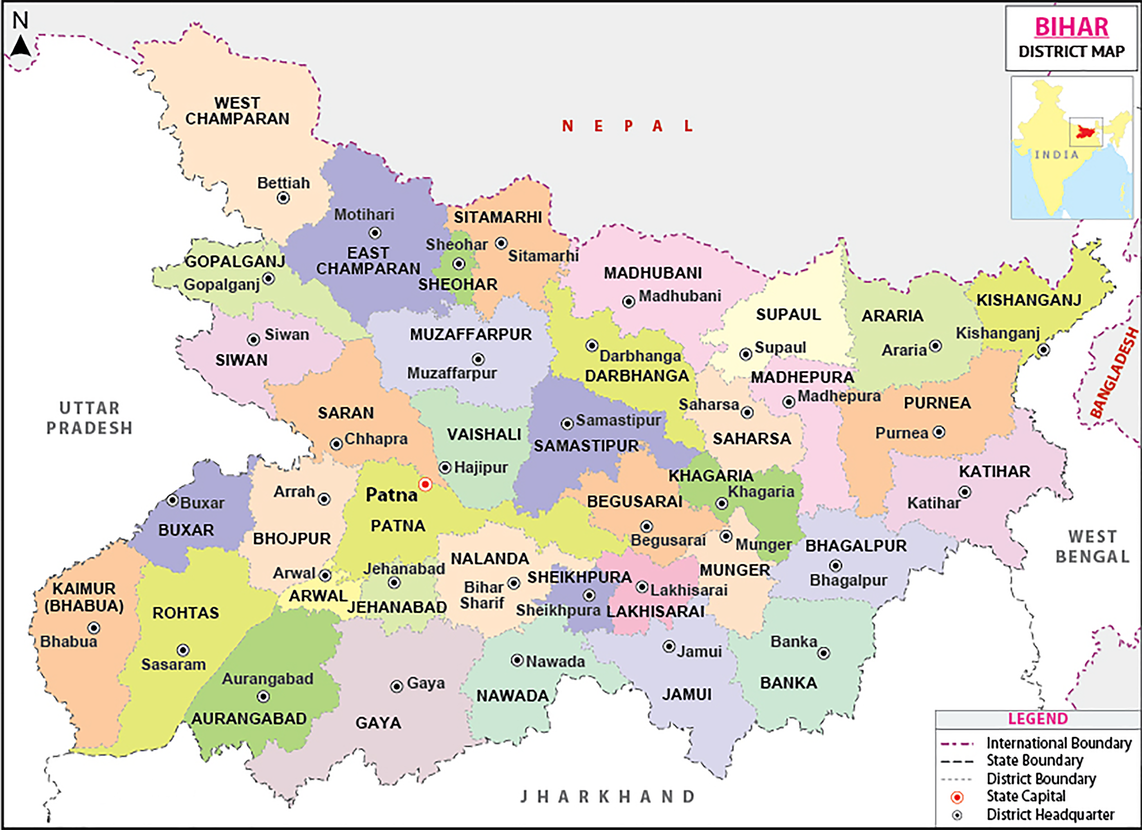
| State Animal: Bull |
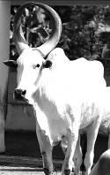 |
State Flower: Marigold |
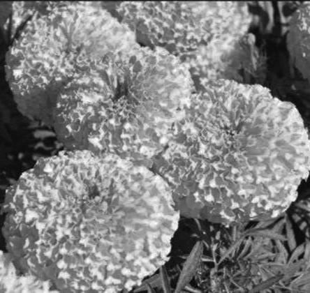 |
| State Bird: Sparrow |
 |
Main painting: Madhubani |
 |
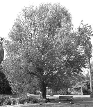
| State Tree: Peepal |
 |
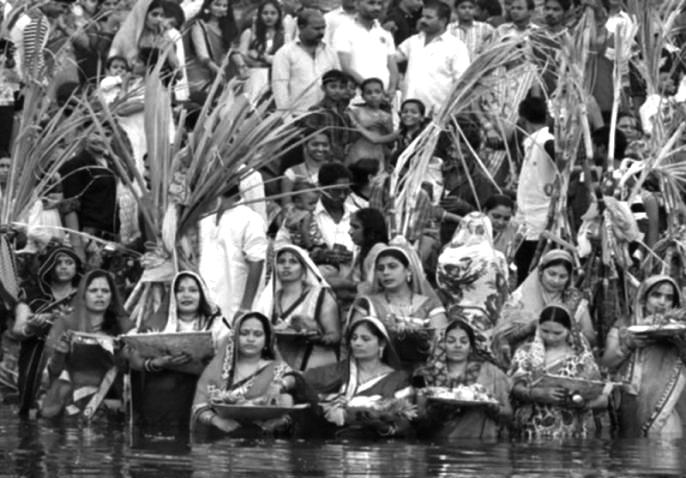
Main Festival: Chhath Puja |
 |
Bihar : General Information
- State name – Bihar, it is believed that due to the abundance of Buddhist monasteries (viharas) in the region, This region was named Bihar. It is noteworthy that in ancient times this area was a major center of Buddhism.
- Statehood Day (Bihar Diwas) – March 22, 1912
- State capital – Patna (In ancient times Pataliputra, Pushppur, Kusumpur and Azimabad have been other names.)
- Geographical location of the state – 24°20'10" to 27°31'15" North Latitude and between 83°19'50" to 88°17'40" East Longitude.
- The area of the state is – 94,163 sq. km. (13th largest state in the country)
- Length from North to South – 345 km.
- Length from East to West – 483 km.
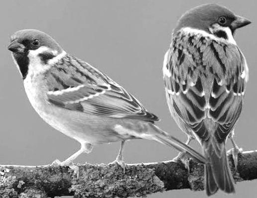
- States bordering the state – 3 [West Bengal (East), Uttar Pradesh (West) and Jharkhand (South)]
- The country bordering the state – Nepal (in the north)
- Total geographical area (all over India) – 2.86%
- Districts bordering Nepal – 7 [West Champaran, East Champaran, Sitamarhi Madhubani, Supaul, Araria and Kishanganj]
- District bordering Uttar Pradesh – 8 [(Rohtas, Kaimur, Buxar, Bhojpur, Saran, Siwan) Gopalganj and West Champaran]
- Districts bordering West Bengal – 3 [Kishanganj, Purnia and Katihar]
- Districts bordering Jharkhand – 8 [Bhagalpur, Banka, Jamui, Nawada, Gaya, Aurangabad, Rohtas and Katihar]
- District adjoining Bihar's capital Patna – 9[Arwal, Jehanabad, Nalanda, Lakhisarai, Begusarai, Samastipur, Vaishali, Saran, Bhojpur]
- Largest district in terms of area – West Champaran
- Smallest district in terms of area – Sheohar
- Northernmost District – West Champaran
- Southernmost district – Gaya
- Western most district – Kaimur
- Easternmost District – Kishanganj
- State Climate – Monsoon
- Normal rainfall – 1,205 mm
- Highest rainfall district – Kishanganj
- The districts with minimum rainfall – Kaimur, Rohtas, Aurangabad and Gaya.
- Hottest place – Gaya
- The average distance from the beach is – 200 km.
- The average height above sea level is – 173 feet (about 53 m).
- Total Population of the State (Census– 2011) – 10,40,99,452 (3rd place in the country)
- Male – 5,42,78,157 in the total population of the state
- Female – 4,98,21,295 in the total population of the state
- Percentage share of total population of India – 8.60% In terms of total population, the third place in the country (first – Uttar Pradesh, while the second – Maharashtra)
- Decade growth in population (2001–2011) – 25.42% (6th rank in the country)
- Population Density (person/sq.km.) – 1,106 (1st in the country, Census– 2011)
- Most Populated District – Patna (58,38,465)
- District with minimum population – Sheikhpura (6,36,342)
- District with highest decadal growth rate of population – Madhepura (31.12%)
- District with lowest decadal growth rate of population – Gopalganj (19.02%)
- District with highest population density – Sheohar (1880 persons/sq.km.)
- District with minimum population density – Kaimur (Bhabua) (488 persons/sq.km.)
- Literacy rate (as per 2011, Census) – approximately 61.80% (71.20% male, 51.50% female)
- District with highest per capita income – Patna
- District with minimum per capita income – Sheohar (Madhepura in other source)
- District with highest literacy rate – Rohtas (73.37%)
- District with lowest literacy rate – Purnia (51.08%)
- District with highest male literacy rate – Rohtas (82.88%)
- District with lowest male literacy rate – Purnia (59.06%)
- District with highest female literacy rate – Rohtas (62.97%)
- District with lowest female literacy rate – Saharsa (41.68%)
- Sex Ratio – 918
- District with highest sex ratio – Gopalganj (1021)
- District with lowest sex ratio – Munger (876)
- Child Sex Ratio (0–6 Years) – 935
- District with highest child sex ratio – Kishanganj (971)
- District with lowest child sex ratio – Vaishali (904)
- District with highest urban population – Patna (25,14,590)
- District with minimum urban population – Sheohar (28,116)
- Percentage of rural population to total population – 88.71%
- Percentage of urban population to total population – 11.29%
- Highest percentage of urban population – Patna (43.07%)
- Minimum percentage of urban population – Samastipur (3.47%)
- Scheduled Castes (SC) – 15.9% of the total population
- District with Highest Scheduled Caste Population – Gaya (13,343,51)
- District with highest percentage of SC population – Gaya (30.39%)
- District with minimum scheduled caste population – Sheohar (96,655)
- District with Minimum Scheduled Caste Population Percentage – Kishanganj (6.69%)
- Scheduled Tribes (ST) of the total population – 1.3%
- District with highest ST population – West Champaran (250046)
- District with minimum ST population – Sheohar (318)
- District with highest percentage of ST population – West Champaran (6.35%)
- Districts with minimum percentage of ST population – Aurangabad, Khagaria and Samastipur.
- No. of Administrative Divisions – 09 (Koshi, Darbhanga, Saran, Bhagalpur, Patna, Tirhut, Munger, Magadha and Purnia)
- No. of Districts – 38
- No. of Sub– Divisions – 101
- Block No.– 534
- No. of Panchayats – 8,406
- No. of Police Stations – 853
- No. of Revenue Villages – 45,103
- Number of Lok Sabha Members – 40
- No. of Rajya Sabha members – 16
- Number of seats reserved for Scheduled Castes in Lok Sabha – 6
- Legislature – Bicameral (upper house – Legislative council, Lower house – Assembly)
- Number of Vidhan Sabha Members – 243
- Number of Legislative Council Members – 75
- State Symbol – Bodhi tree (located between two swastikas)
- Official language – Hindi
- Second official language – Urdu
- State fish – Mangur
- State anthem – Mere Bharat Ke Kanth har, Tum Ko Shat– Shat Vandan Bihar...
- State Prayer – Meri raftaar pe suraj ki kiran naaz kare...
- No. of Universities – 23
- Folk dances – Kathghodwa, Chhau, Launda, Dhobia, Jhijhiya, Jharni, Karma and Domkach.
- Major Forest Type – Deciduous


