Subarnarekha River | 23 Jun 2025
Source: TH
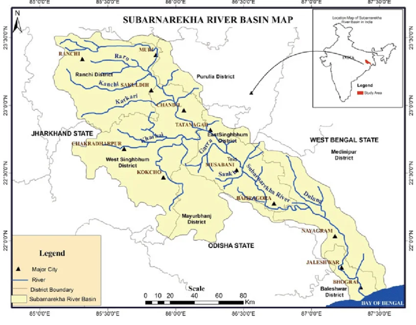
Balasore district in Odisha was flooded after water from Chandil Dam, built across the Subarnarekha River in Jharkhand, was allegedly released without prior intimation to Odisha.
About Subarnarekha River
- Origin & Course: It originates near Nagri village in Ranchi district, Jharkhand and covers about 395 km before emptying into the Bay of Bengal, forming an estuary between the Ganga and Mahanadi deltas.
- Tributaries: Kharkai (joins at Sonari/Domuhani near Jamshedpur), Kanchi, Karkari, Roro, Harmu Nadi, Damra, Singaduba, Dulunga, and others.
- Basin & Geography: It spreads across Jharkhand, Odisha, and West Bengal, bounded by the Chota Nagpur Plateau (north & west), Baitarani basin (south), Bay of Bengal (south-east), and Kasai Valley (east).
- The river forms Hundru Falls along its course.
- Dams & Reservoirs: Getalsud Reservoir, Chandil Dam, Galudih Barrage, Icha Dam, and Kharkai Barrage.