Erra Matti Dibbalu | 28 Sep 2019
Erra Matti Dibbalu is dissected and stabilized coastal red sediment mounds, located between Visakhapatnam and Bheemunipatnam in Andhra Pradesh.
- Formation:
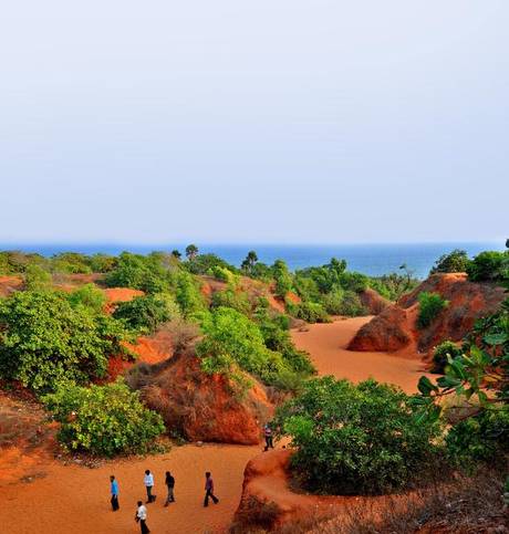
- Formed around 12,000 years ago due to sea-land interaction.
- Comprises a mixture of sand (40-50%), silt and clay (another 50%) with oxidation imparting the unique red colour.
- Significance:
- They are geologically important as they represent the geological history of the late Quaternary period and carry the imprints of the fall of sea level and its subsequent rise, the impact of climate, monsoon and geological processes on the sediments.
- They are anthropologically and archeologically important as they possibly contain mesolithic and neolithic cultural materials as well.
- Recognition:
- It was recognised as a national geo-heritage site in 2014 and as a protected site by the Andhra Pradesh Government in 2016.
- The Geological Survey of India (GSI) declares geo-heritage sites/ national geological monuments for protection and maintenance
- It was recognised as a national geo-heritage site in 2014 and as a protected site by the Andhra Pradesh Government in 2016.
- Other Similar Place: The only other place in the country to have a similar stretch of red sand dunes is Tamil Nadu, which has the Teri dune complex.
Geological Survey of India
- The Geological Survey of India (GSI) was set up in 1851 primarily to find coal deposits for the Railways.
- The main functions of the GSI relate to creation and updation of national geo-scientific information and mineral resource assessment.
- It is headquartered in Kolkata, and has six regional offices located at Lucknow, Jaipur, Nagpur, Hyderabad, Shillong and Kolkata and State Unit offices in almost all States of the country.
- Presently, GSI is an attached office to the Ministry of Mines.