The River Basin Management Scheme | 18 Apr 2026
Why in News?
The River Basin Management (RBM) Scheme has been extended for the 16th Finance Commission period spanning 2026–27 to 2030–31, highlighting India’s renewed focus on integrated and sustainable water resource management at the basin level.
What is the River Basin Management (RBM) Scheme?
- About: The RBM Scheme is a central sector initiative spearheaded by the Ministry of Jal Shakti (Department of Water Resources, River Development, and Ganga Rejuvenation).
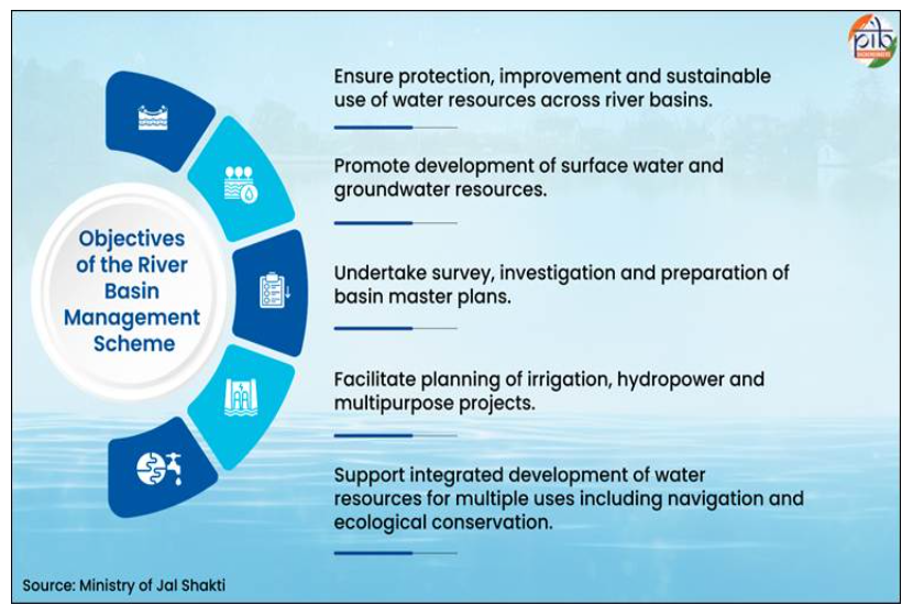
- Its primary goal is to ensure the integrated planning, sustainable use, and protection of surface and groundwater resources at the river basin level.
- Instead of looking at water resources in isolation, the scheme treats an entire river basin, including its rivers, tributaries, lakes, and groundwater, as a single, interconnected ecosystem.
- Institutional Framework: The RBM Scheme consists of two broad components: the Brahmaputra Board and the Investigation of Water Resources Development Scheme (IWRDS) implemented through the Central Water Commission (CWC) and National Water Development Agency (NWDA).
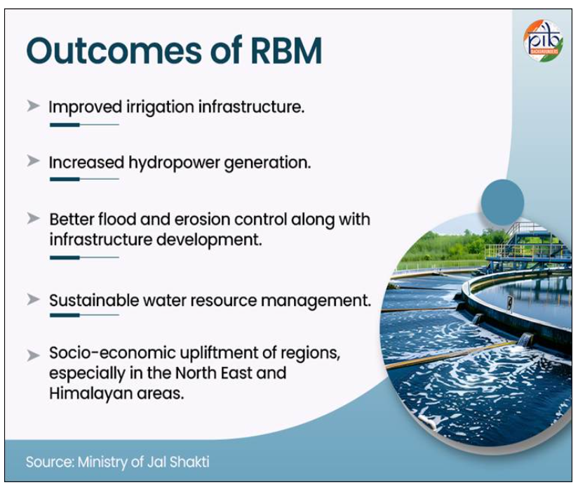
- Brahmaputra Board: Focuses on river basin planning, flood control, erosion management, drainage development, and sustainable water resource management in the North Eastern Region.
- Central Water Commission (CWC): Conducts surveys, investigations, and prepares Detailed Project Reports (DPRs) for water resource projects in remote terrains.
- National Water Development Agency (NWDA): Handles national-level water planning, specifically the preparation of feasibility reports for the Interlinking of Rivers (ILR) programme.
- Geographical Priority: It strategically targets water-rich yet underdeveloped regions that are critical for national security, water security, cross-border management, flood control, and ecological stability.
- Key focus areas include the Brahmaputra, Barak, Teesta, and Indus basins, heavily prioritizing the North Eastern States, Jammu & Kashmir, and Ladakh.
- Key Objectives:
- Flood and Erosion Management: Implementing physical protection measures, such as securing Majuli Island in Assam from severe river currents.
- Project Development: Preparing DPRs to expand irrigation capacity and harness hydropower generation in Himalayan rivers.
- Technological Integration: Utilizing modern mapping and surveying tools like Geographical Information System (GIS), LiDAR, and drone surveys to ensure pinpoint accuracy in topographical and hydrological planning.
- Community Integration: Promoting local practices like springshed management among tribal and rural communities in hilly regions.
River Basin
- About: A river basin is the area of land drained by a river and its tributaries. Its key features include tributaries (smaller streams joining a main river), confluence (the point where rivers meet), watershed (highland boundary separating basins), source (origin of the river), and mouth (where it drains into a sea, lake, or ocean).
- A river basin is regarded as the basic hydrological unit for planning and development of water resources in India.
- River Basins of India: India’s drainage system is classified into 20 river basin groups, comprising 12 major and 8 composite river basins.
- Major river basins, each with a drainage area exceeding 20,000 sq km, include the Indus, Ganga–Brahmaputra–Meghna, Godavari, Krishna, Cauvery, Mahanadi, Pennar, Brahmani–Baitarani, Sabarmati, Mahi, Narmada, and Tapti.
- The Ganga–Brahmaputra–Meghna basin is the largest, with a catchment area of around 11.0 lakh km², accounting for over 43% of the total catchment area of major rivers.
- Medium river basins have drainage areas between 2,000 and 20,000 sq km, while minor basins are below 2,000 sq km.
- The 8 composite basins combine smaller rivers, such as the Subarnarekha group, east-flowing rivers between major basins, west-flowing rivers of Kutch and Saurashtra (including Luni), coastal rivers from Tapi to Kanyakumari, and inland drainage areas of Rajasthan.
- Notably, all major river basins and many medium basins are inter-state in nature, together spanning nearly 81% of India’s geographical area.
- Major river basins, each with a drainage area exceeding 20,000 sq km, include the Indus, Ganga–Brahmaputra–Meghna, Godavari, Krishna, Cauvery, Mahanadi, Pennar, Brahmani–Baitarani, Sabarmati, Mahi, Narmada, and Tapti.
Frequently Asked Questions (FAQs)
1. What is the River Basin Management (RBM) Scheme?
It is aCentral Sector Scheme aimed at integrated planning and sustainable management of surface and groundwater resources at the river basin level.
2. Which institutions implement the RBM Scheme?
It is implemented through theBrahmaputra Board, Central Water Commission (CWC), and National Water Development Agency (NWDA).
3. What are the priority river basins under RBM?
Key basins includeBrahmaputra, Barak, Teesta, and Indus, focusing on the North-East and Himalayan regions.
4. What is the role of NWDA under the RBM Scheme?
NWDA handlesInterlinking of Rivers (ILR), feasibility studies, and inter-basin water transfer planning.
5. What is the significance of RBM Scheme?
It strengthenswater security, flood control, ecological stability, and regional development, especially in vulnerable and border regions.
UPSC Civil Services Examination, Previous Year Question (PYQ)
Prelims:
Q1. With reference to the Indus river system, of the following four rivers, three of them pour into one of them which joins the Indus directly. Among the following, which one is such a river that joins the Indus direct? (2021)
(a) Chenab
(b) Jhelum
(c) Ravi
(d) Sutlej
Ans: (d)
Mains
Q. Discuss the Namami Gange and National Mission for Clean Ganga (NMCG) programmes and causes of mixed results from the previous schemes. What quantum leaps can help preserve the river Ganga better than incremental inputs? (2015)